JACKSONVILLE, Fla. — The First Coast News Most Accurate Weather Team is tracking the latest on Helene at this page here.
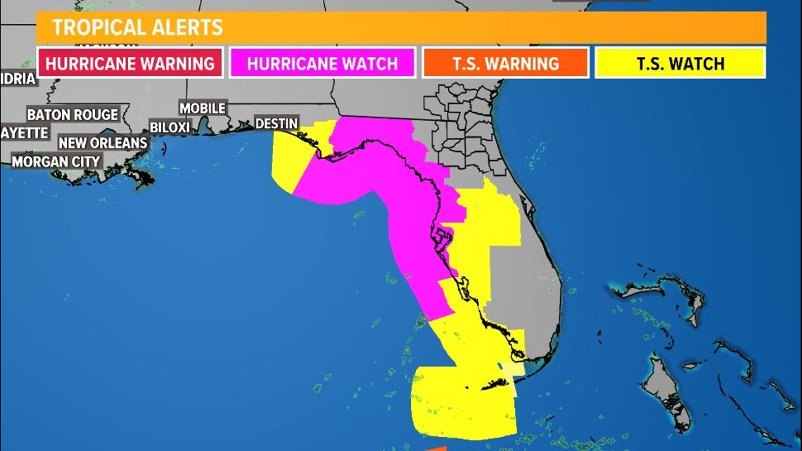
Per the National Hurricane Center: A Hurricane Watch has been issued for the Gulf Coast of Florida from Englewood northward and westward to Indian Pass, including Tampa Bay.
A Tropical Storm Watch has been issued for the Gulf Coast of Florida from Indian Pass to the Walton/Bay County Line and from north of Bonita Beach to south of Englewood.
A Storm Surge Watch has been issued from Indian Pass Florida southward to Bonita Beach Florida, including Tampa Bay and Charlotte Harbor.
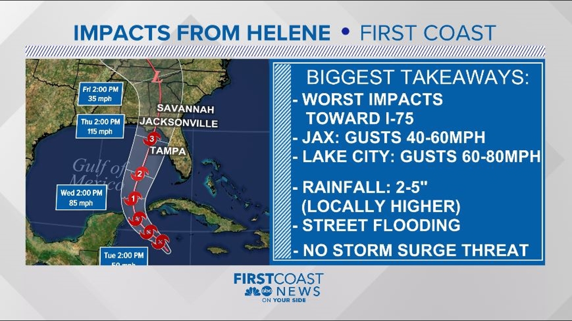
Potential Tropical Cyclone Nine will develop into Helene in the next 12-24 hours, and will be hurricane strength, according to current forecasting, by Wednesday.
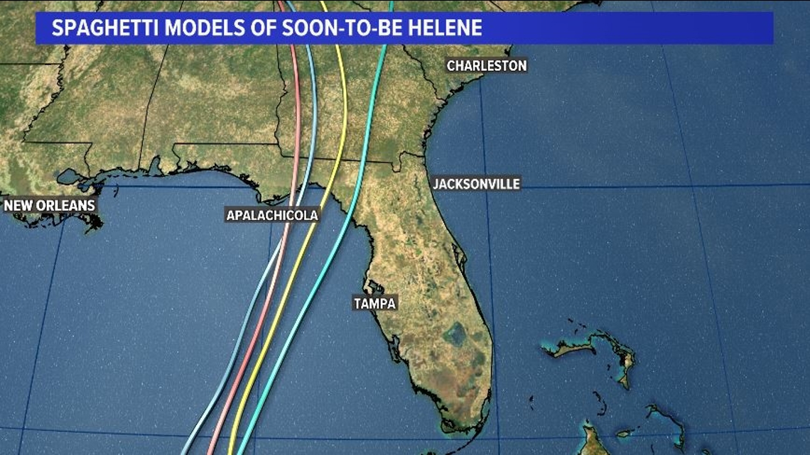
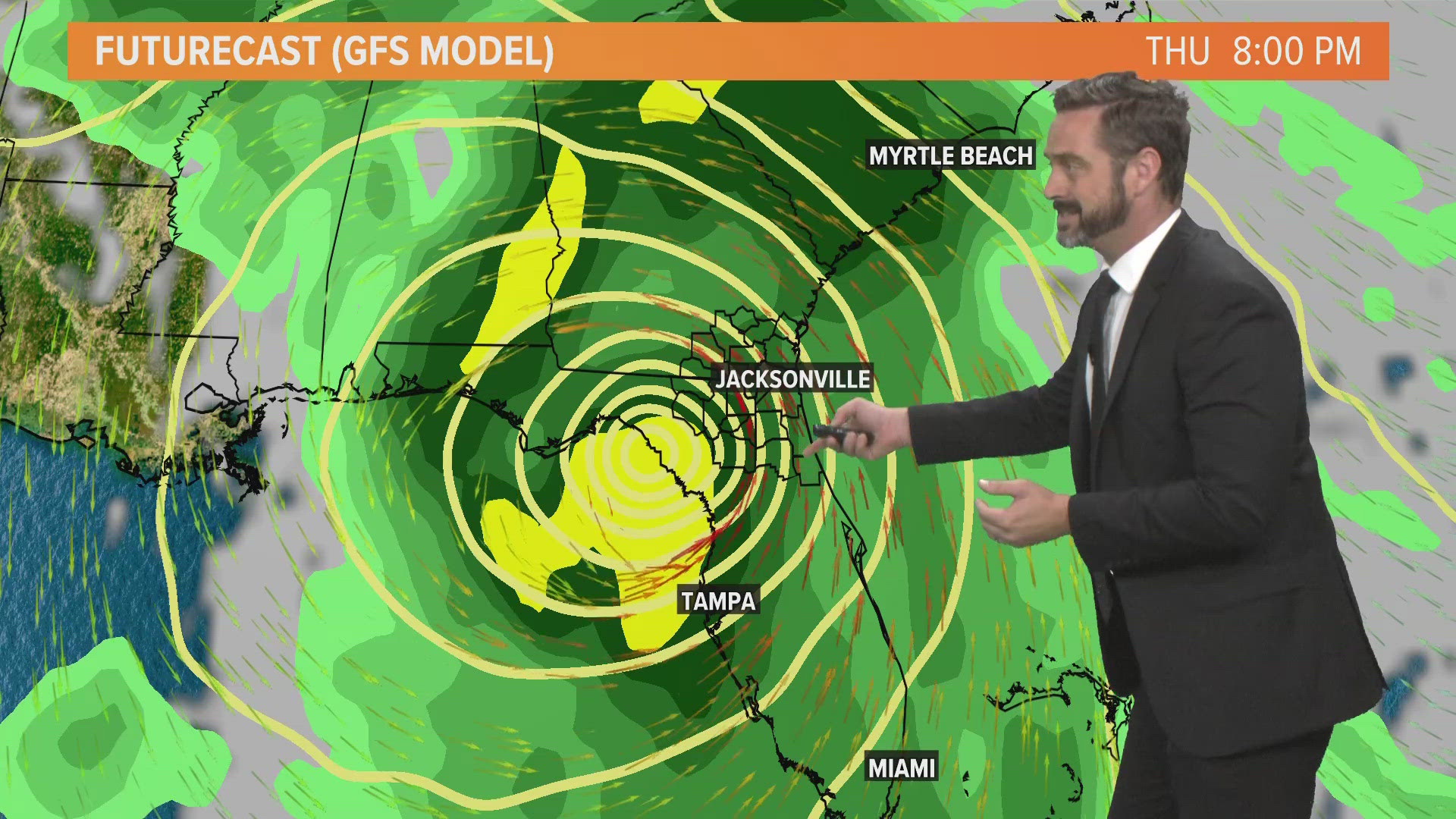
Adjustments to the forecast may need to be made once it fully organizes around a center of circulation, but current models would suggest a landfall along Florida's Big Bend Thursday evening.

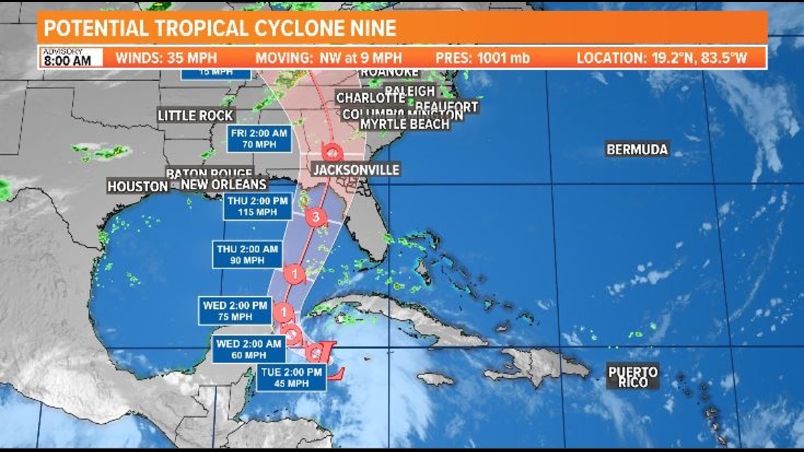
Both the intensity and directional forecasts have this storm becoming a hurricane by Wednesday.
The First Coast could begin feeling impacts from this system on Thursday, with some areas along the I-75 corridor getting hurricane force winds and flooding rains.
The First Coast News Most Accurate Weather Team issued a Weather Impact Alert Day for Thursday.
Please check back here often as conditions can change rapidly, expect frequent updates.

