JACKSONVILLE, Fla. — The Sunshine State is living up to its name this year, as summer temperatures have hit historic highs throughout parts of Florida. The heat and humidity have been relentless for the past several months and you might be wondering when we might finally get a break.
How hot has summer been so far?
Since First Coast News is located in Jacksonville, Florida, we will use average temperatures recorded from the Jacksonville International Airport.
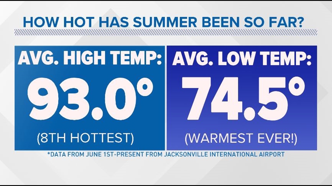
The average high temperature recorded in Jacksonville this season (June through August) has been 93 degrees, which would make for the eighth highest average high in recorded history. At an average summer morning low of 74.5 degrees, we crush the previous record of 74.2 set back in 1968.

Warmer oceans & higher humidity levels inhibit our overnight temperatures from cooling down as much as they used to. Basically, higher dewpoints lead to warmer overnight temperatures.
So when will it cool down?
Well, that depends on what you consider "cool." If you're waiting for the average high to dip below 85 degrees, you'll need to wait until October. But, if you're just waiting for the "9" to leave the beginning of the number, those averages kick in in September.
Our average high temperatures first dip out of the 90s and back into the upper 80s the first week of September. With ocean temperatures typically still in the 80s, humidity levels typically remain high through much of September, keeping heat indices in the 90s during many afternoons.
The average high in Jacksonville for Sept. 1 is 89 degrees. By Sept. 30, it dips to 85 degrees. The average lows for those dates are 73 degrees and 67 degrees.

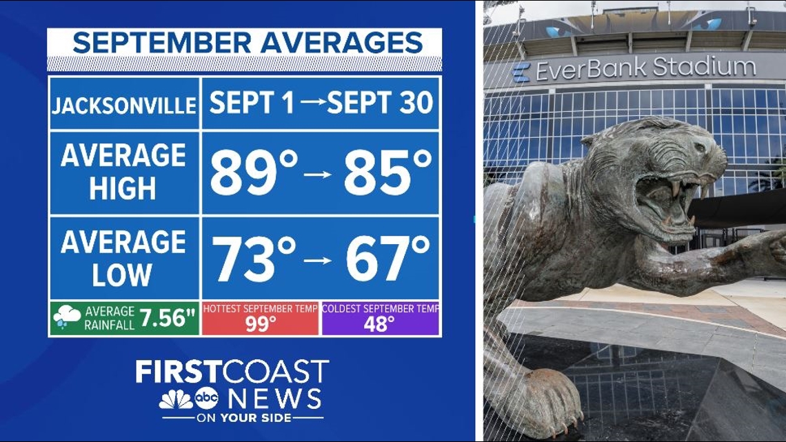
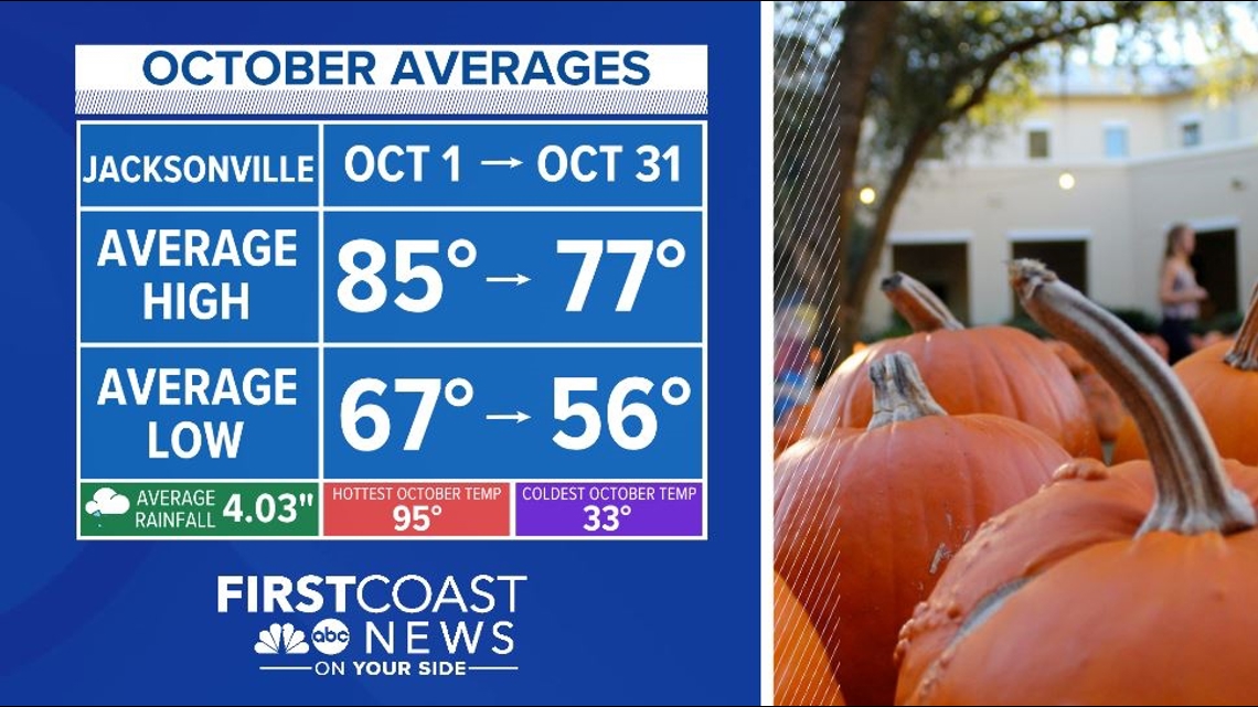
Climatologically, we don't really begin to cool down until the first week of October across the First Coast. We can still see temperatures in the 90s, but our average high temperature drops below 85 degrees after October 1. By Halloween, we can expect the average highs to finally reach below 80 degrees.

By October, the jet stream will begin to sag farther south and can often become more meridional, meaning cold fronts can become more likely. Although these fronts can bring storms, they are often followed by cooler and drier air behind them, making conditions feel much more comfortable for pumpkin patches and football games.
By the end of November, Floridians will be enjoying average highs in the 70s. While the leaves don't always change colors around this time, the license plates sure do.

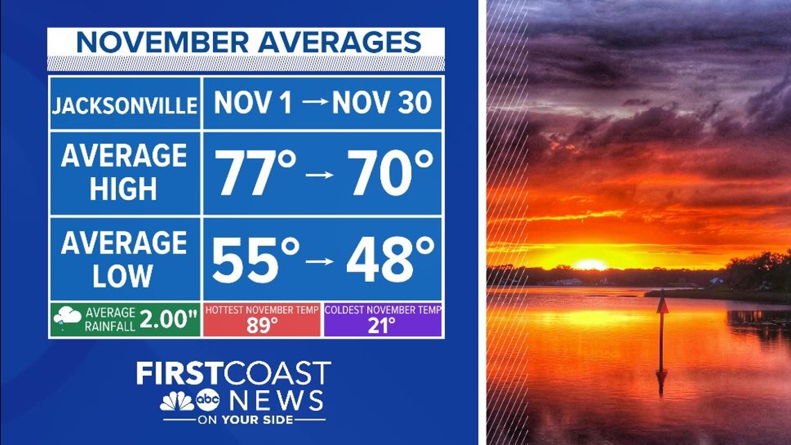
The above numbers are the average temperatures, which doesn't mean the First Coast won’t be subjected to hotter than normal days or blasts of cold air at times over the next several months. To get a look at your near-term forecast, check out First Coast News' daily local weather article.


