
JACKSONVILLE, Fla. — You have likely heard the Most Accurate Weather Team discuss La Niñas in the Pacific and how those colder waters usually lead to a more active Atlantic hurricane season.
A phenomenon similar to La Niña could occur in the Atlantic, called the Atlantic Niña. It does not have the same global impacts as the well-known Pacific La Niña, but it is similar to La Niña in that it means cooler than normal waters. So, what exactly is Atlantic Niña?
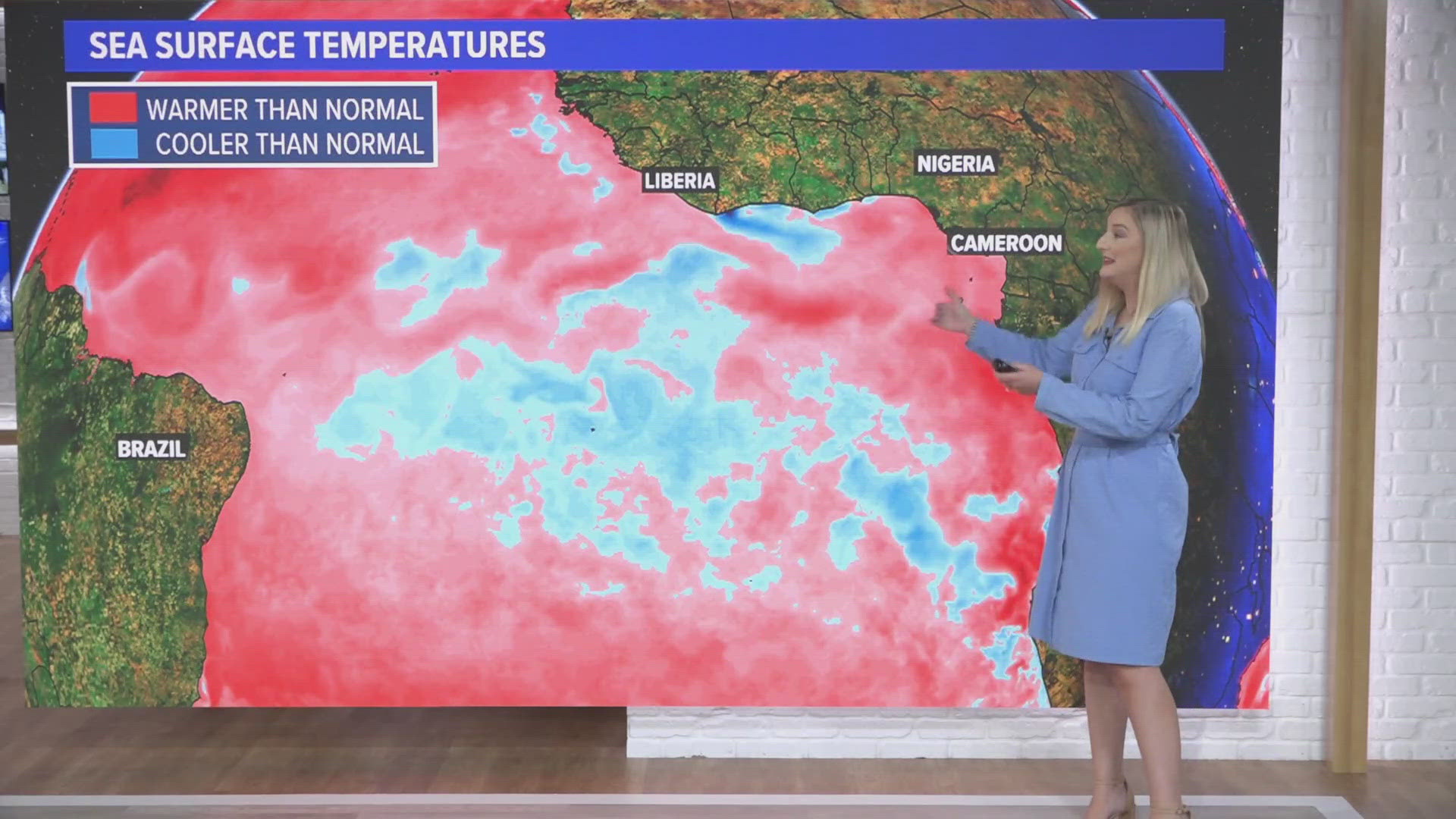
To declare Atlantic Niña this year, the central equatorial Atlantic has to be 0.5 - 1 degree Celsius (0.9–1.8 degrees Fahrenheit) colder than normal until the end of August.
It is not uncommon for sea surface temperatures to be cooler this time of year. Waters in the eastern equatorial Atlantic are warmest in spring and coolest in July and August. What makes it an Atlantic Niña is just how cool it is (0.5 – 1 degree Celsius).
So, why are the waters cooler now? We have to look to the Inter Tropical Convergence Zone (ITCZ) for the answer. The ITCZ is a band of showers and storms near the equator. The band is farther north in the Northern Hemisphere summertime, and the storms pull in air towards it. That sucks in air from the equatorial Atlantic, which pushes surface water north as well. Deeper and colder ocean water rises to the surface to replace that water that moves north (a process called upwelling), and thus a pool of cooler water exists in its place later in summer.
What many of us want to know is if Atlantic Niña can impact hurricane season.
Atlantic Niños, which is warmer than normal waters in the same area, have been shown to increase the likelihood of powerful hurricanes developing near the Cape Verde islands. However, we cannot say if Atlantic Niñas inhibit hurricanes or not. History shows us there have been both very active seasons and less active seasons during Atlantic Niñas. If one develops, only time will tell how it impacts our hurricane season, and we will be watching closely.
Two things make this possible Atlantic Niña a bit unprecedented. The first thing that’s uncommon is the fast swing in temperatures. We actually had a strong Atlantic Niño (the strongest warm event since 1982) in February and March. We’ve never seen temperatures plummet to an intense cooling event so quickly.
Secondly, upwelling is usually associated with stronger southeasterly trade winds, but the winds in June and July were observed to be weakening. Weaker winds were thought to be quite unfavorable for Atlantic Niña conditions, and the National Oceanic and Atmospheric Administration (NOAA) calls the development of cool anomalies “quite perplexing.”
NOAA said, “We will need to dig deeper to reveal the exact causes of this seemingly unusual event.”
We will keep you updated!