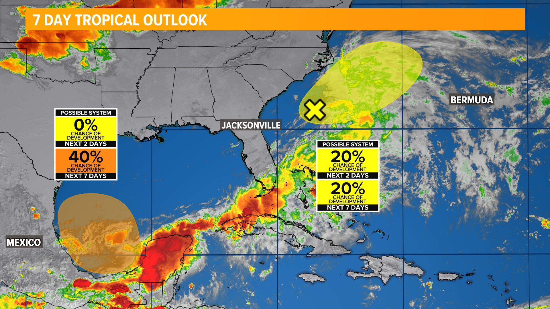
JACKSONVILLE, Fla. — The National Hurricane Center is monitoring two areas for possible tropical development over the coming week.
The broad area of low pressure that gradually crossed the Florida peninsula this week and brought flooding rains to South Florida has now move off the coast and is pulling away out to sea. There is a low risk of future development as this system steers away from the First Coast.

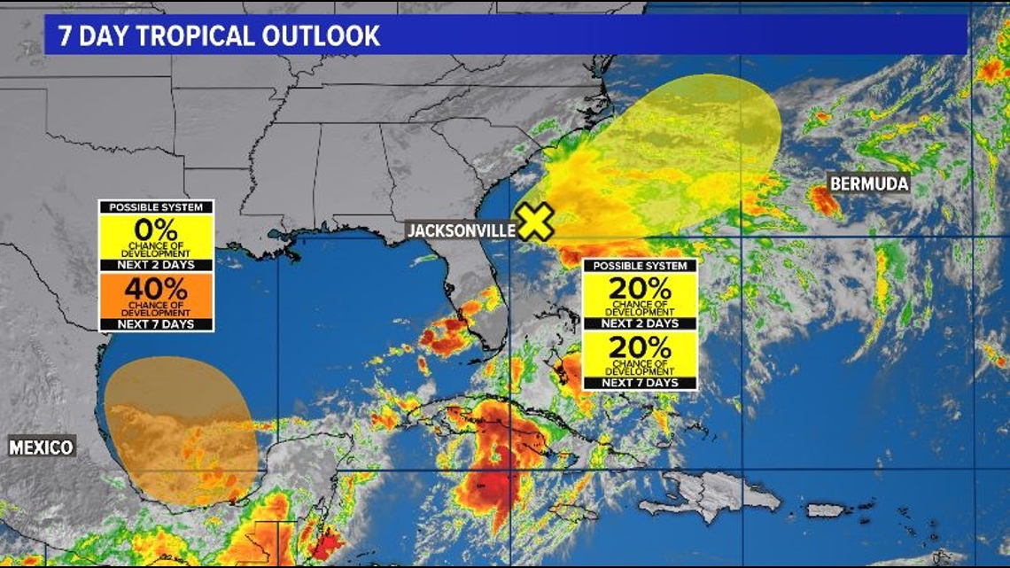
There is a secondary area of interest in the Bay of Campeche that has a slightly higher probability of development over the weekend and into early next week as it drifts to the west-northwest toward Mexico and the Gulf Coast of Texas. This area has a 40% chance of development over the next 7 days and does not currently pose any threat to the First Coast.
This time of year it is not uncommon to see storms develop in the Gulf of Mexico, as that is where climatologically speaking they are most likely to occur. On average, we see a hurricane form in June every five years with the first named storm on average taking place on June 20.
In the past decade, though, these storms have formed before that date, with 2024 being the latest start to hurricane season since 2014.
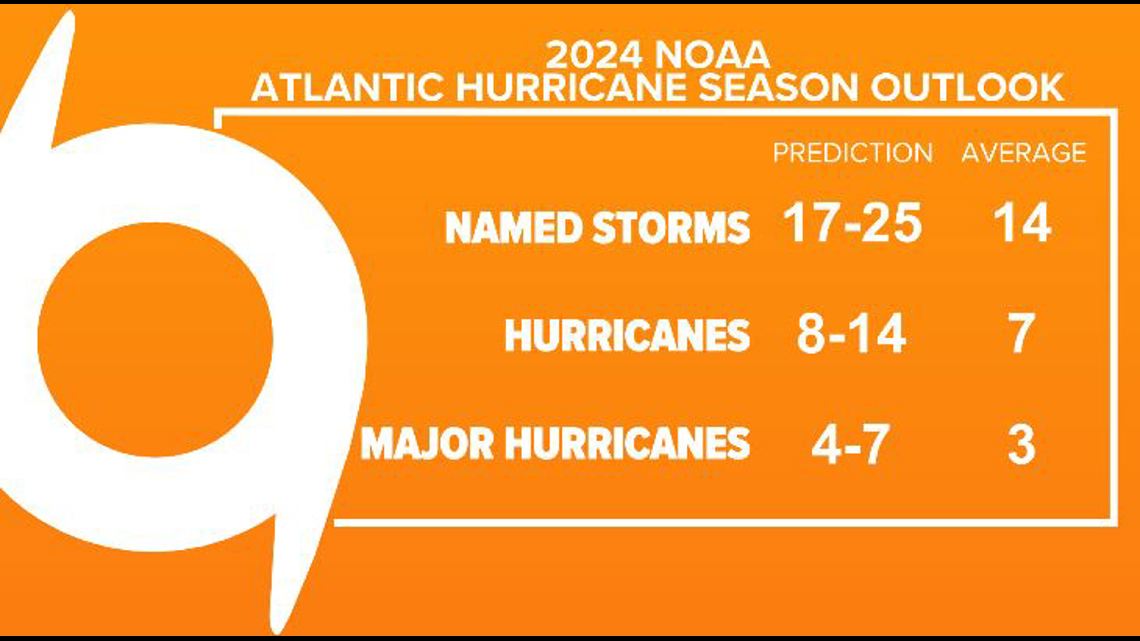
That fact is a bit misleading, though, as ingredients are favorable across the Atlantic for an above-average hurricane season. The forecast from NOAA discussing this can be found here.