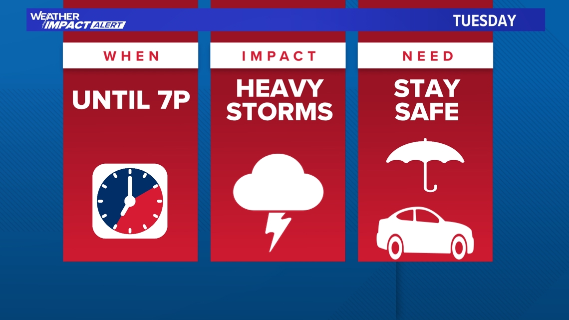
JACKSONVILLE, Fla. — Editor's Note: Due to storms decreasing coverage and moving away from our major populated areas, First Coast's Most Accurate Weather Team is canceling the Weather Impact Alert Day at 6 p.m. Tuesday.
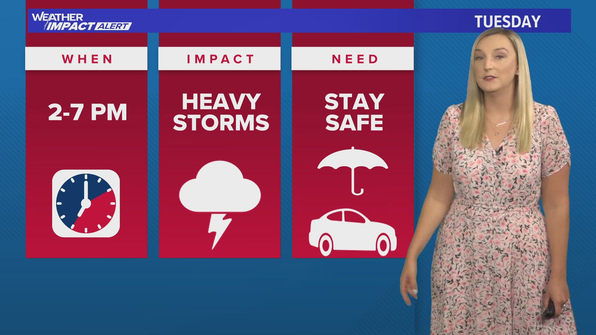
WHEN: Tuesday, July 2, from 2 p.m. to 7 p.m.
IMPACT: 70% coverage of rain and thunderstorms around the Jacksonville metro area and much of the First Coast. Heavy rain, localized flooding (especially in areas that have recently received heavy rainfall) and frequent lightning strikes will be the primary threats Tuesday.
NEED: Take it slow on the roads and be mindful of blinding downpours and the potential for hydroplaning.
Listen for thunder and be able to take shelter when thunderstorms begin. Have your First Coast News App handy to track out live radar and have severe weather alerts sent directly to you.

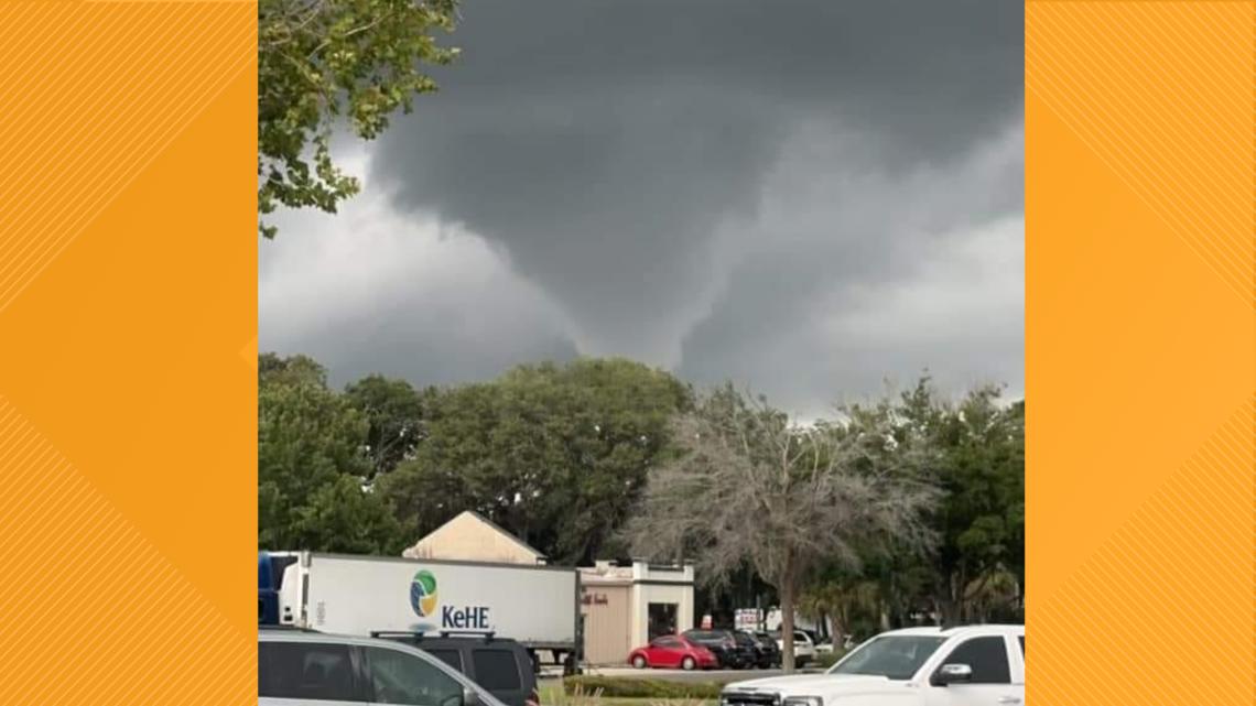
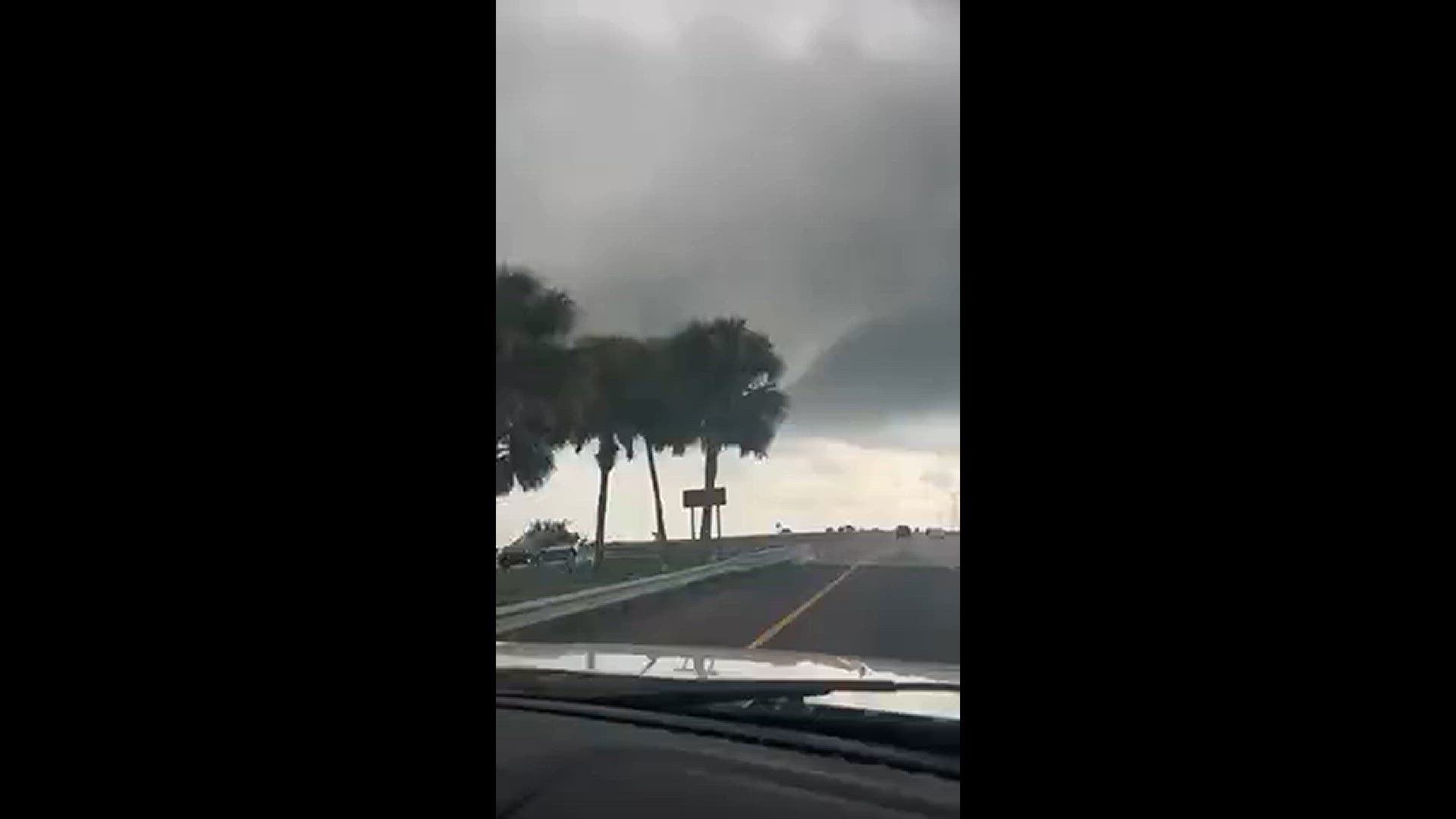
The Nassau County Sheriff's Office briefly closed the Thomas J. Shave Bridge Tuesday morning after spotting two funnel clouds in the same area the picture and video below were taken.
The National Weather Service did confirm there was a waterspout near Fernandina Beach Tuesday morning.