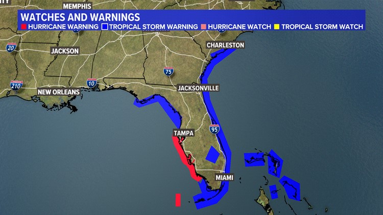
ST. PETERSBURG, Fla. — People living along the western Gulf coast of Florida and just south of Tampa Bay are experiencing a "life-threatening" storm surge from Hurricane Ian, according to the National Hurricane Center.
About 12-18 feet of storm surge flooding is forecast along the coast from Bonita Beach to Englewood. Farther north, from Engelwood to the middle of Longboat Key, 6-10 feet of water is expected.
Tampa Bay and locations along the western Gulf Coast northward can see 4-6 feet of water.
Storm surge, according to its definition, "is the abnormal rise in seawater level during a storm, measured as the height of the water above the normal predicted astronomical tide." This is caused by a storm's winds pushing water against and onto the shore.
Several other factors contribute to whether a surge is amplified: the storm's orientation of the coastline with the storm track, the storm's intensity, its size, speed and the floor bed of the Gulf and Tampa Bay.
The Tampa Bay region is at greater risk of storm surge. Just off the coast in the western Gulf, a shallow continental shelf gradually rises until it reaches land. Any water that piles up on the Gulf side has the potential to cause significant issues for coastal communities.
A storm surge warning is in effect for:
- Suwannee River southward to Flamingo
- Tampa Bay
- Lower Florida Keys from Big Pine Key westward to Key West
- Flagler/Volusia Line to the mouth of the South Santee River
- St. Johns River
This means there is a danger of life-threatening inundation, from rising water moving inland from the coastline, during the next 36 hours in the indicated locations.
A storm surge watch is in effect for:
- Florida Keys from the Card Sound Bridge westward to east of Big Pine Key
- Florida Bay
This means life-threatening storm surge is possible during the next 48 hours. People should consider putting their hurricane plans into action Monday into Tuesday, especially if and when warnings are issued.


