JACKSONVILLE, Fla. — Brrr! Folks in Jacksonville, you're finally getting good use out of those winter boots and jackets.
We started off the year with record warmth - hitting 83F and 84F on New Year's Day and January 2 respectively at the Jacksonville International Airport. But then the pattern switched. Things turned chilly and we haven't looked back.
It might have you wondering - what does the rest of January, or even the winter season, have in store for the First Coast?
The Climate Prediction Center gives us a good indication of general patterns and trends, such as temperature and precipitation outlooks.
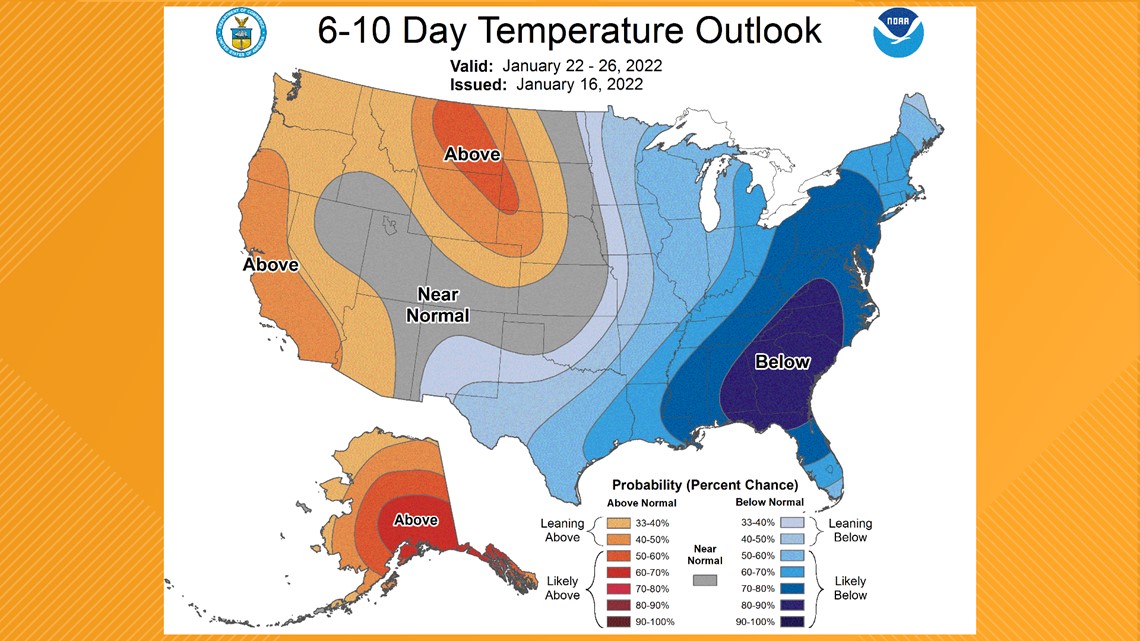
The 6-10 Day Outlook (that's January 22-26) is looking downright cold with temperatures well below average and precipitation near normal.


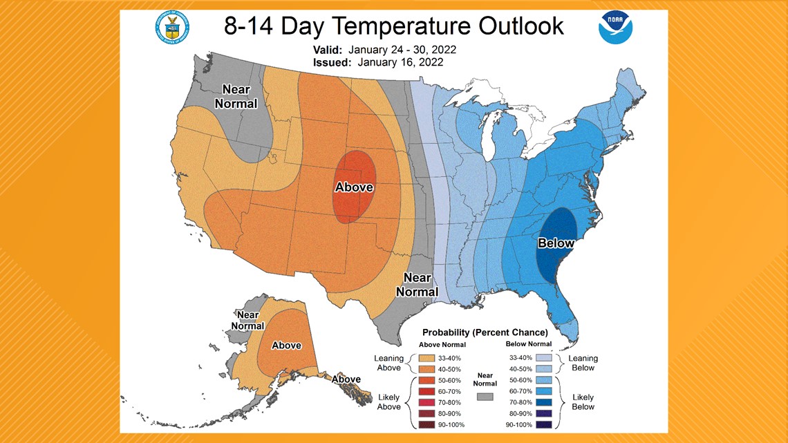
Even the 8-14 Day Outlook (that's January 24-30) is trending colder than normal, but with near normal or just less than normal precipitation.


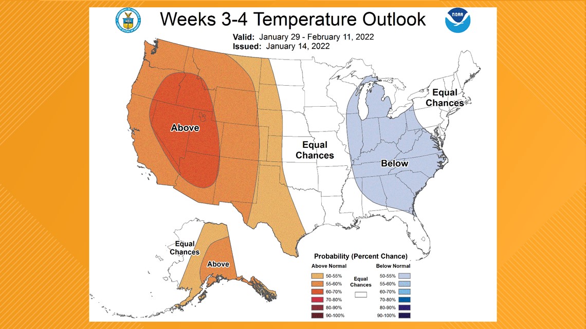
Temperatures may start to moderate back to near normal levels as we turn the calendar to February, according to the CPC's 3-4 Week Outlook (that's January 29-February 11). That's also when precipitation may take a hike to above normal levels.


What is "normal" anyways for Jacksonville in January? As far as temperatures go, our average low is 43F and average high is 65F for the month. Our average monthly precipitation is 3.28". As of January 17, the Jacksonville International Airport has picked up 1.13" of rain.
Now, just "how cold" are we talking to end off January 2022?
Some computer models are showing several more nights with temperatures in the 30s - with some model runs dropping into the upper 20s with wind chills. Remember: this is just guidance, not a forecast! We will continue to fine-tune the numbers as we get closer.
However, we can say with confidence that you'll want to keep those boots and jackets handy!

