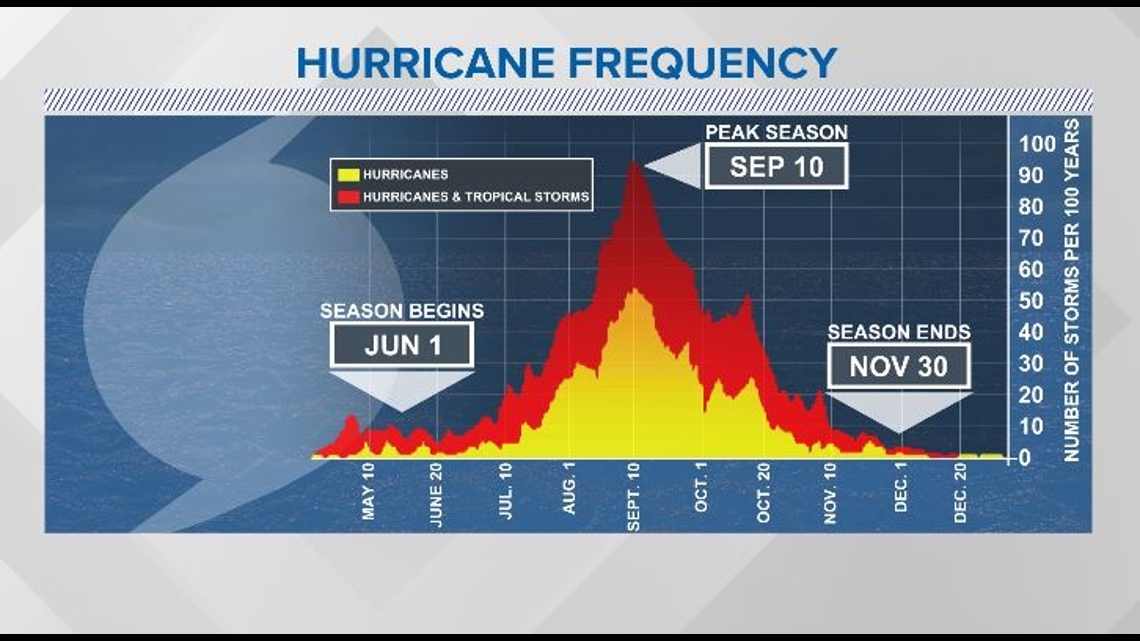
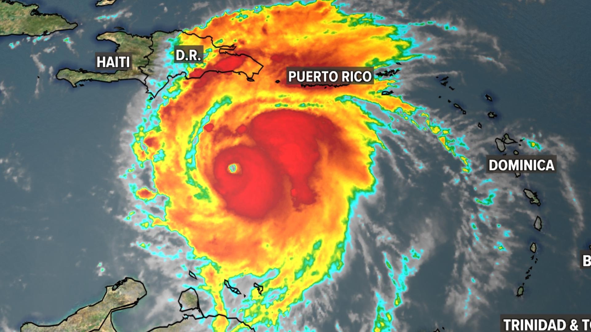
JACKSONVILLE, Fla. — It has been an extremely active hurricane season so far. In late June and early July, the tropics were showing trends usually seen in September.
Meteorologists use a 30-year average, from 1990 to 2020, to see what is "normal" for hurricane season. When comparing the 2024 hurricane season to the average, this season is way ahead of schedule.
We've had 3 named systems already - Alberto, Beryl and Chris. We usually don't have three until early August.

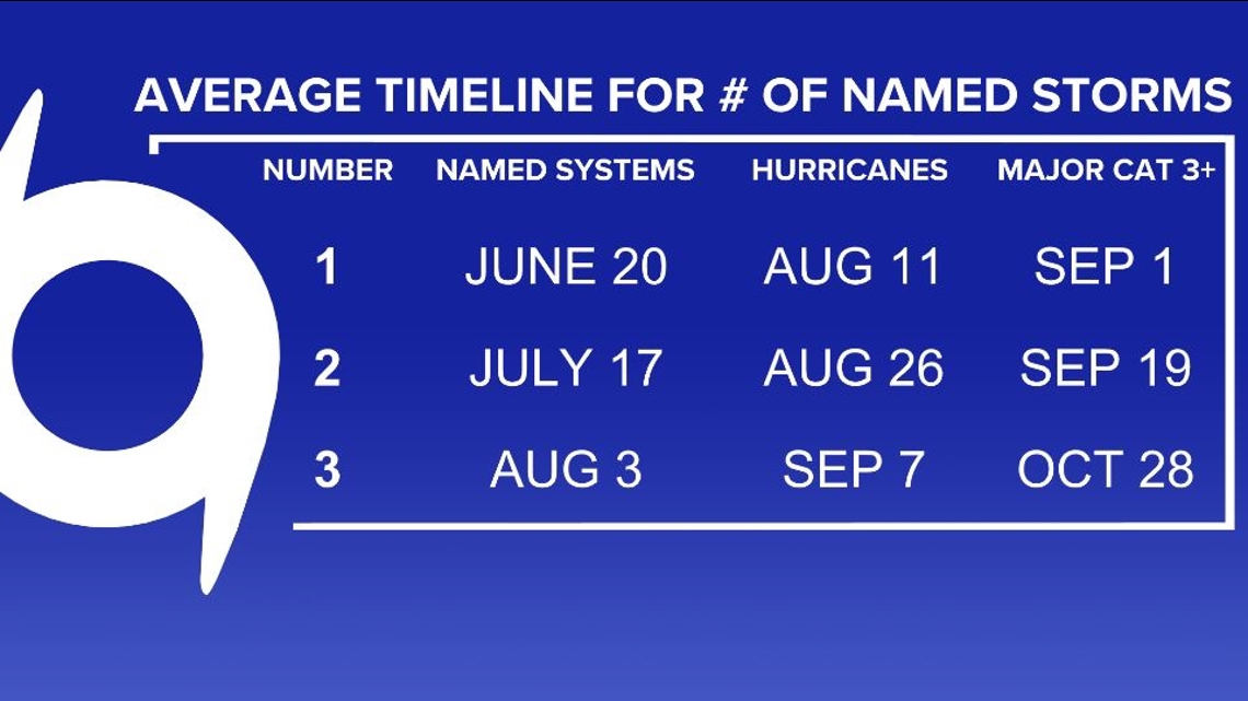
Additionally, our first hurricane and major hurricane occurred in June. That typically happens much later in the season.

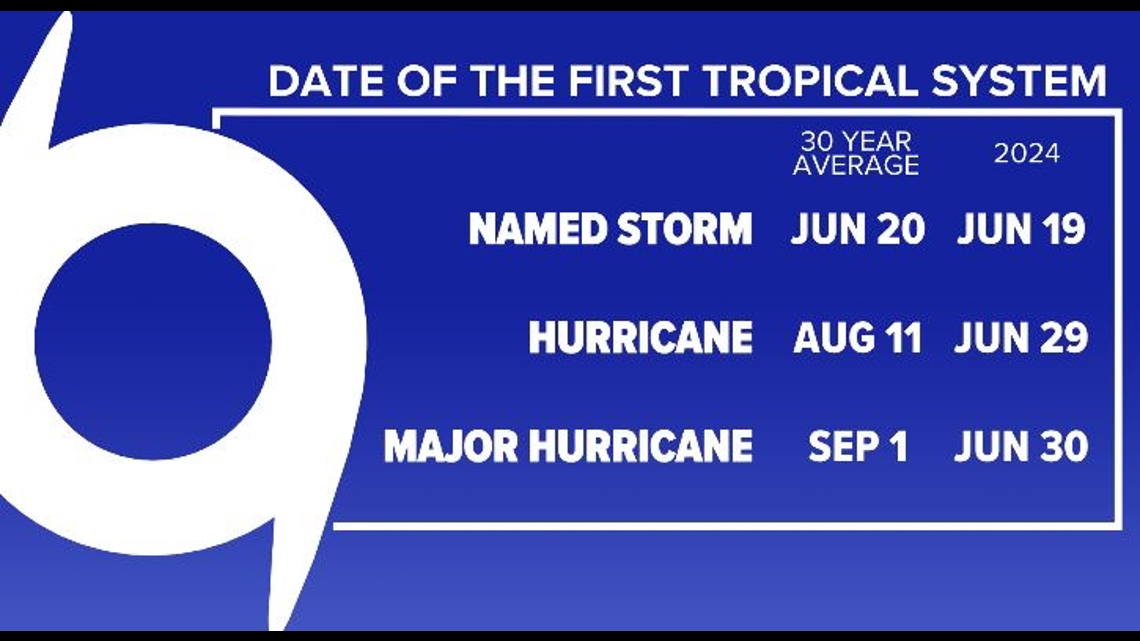
The first named storm usually occurs around June 20. June storms also typically form in the Gulf of Mexico and the Caribbean. For the start of the season, we were on schedule, with Tropical Storm Alberto forming on June 19 over the western Gulf.
Then Beryl formed and rewrote our record books.
Beryl formed out in the Atlantic and became the eastern-most June hurricane. It then rapidly strengthened in a way usually only ever seen in September. The extremely warm Atlantic waters are to thank for this, as usually the waters are not warm enough until September to support the development of a hurricane that strong and that far east.

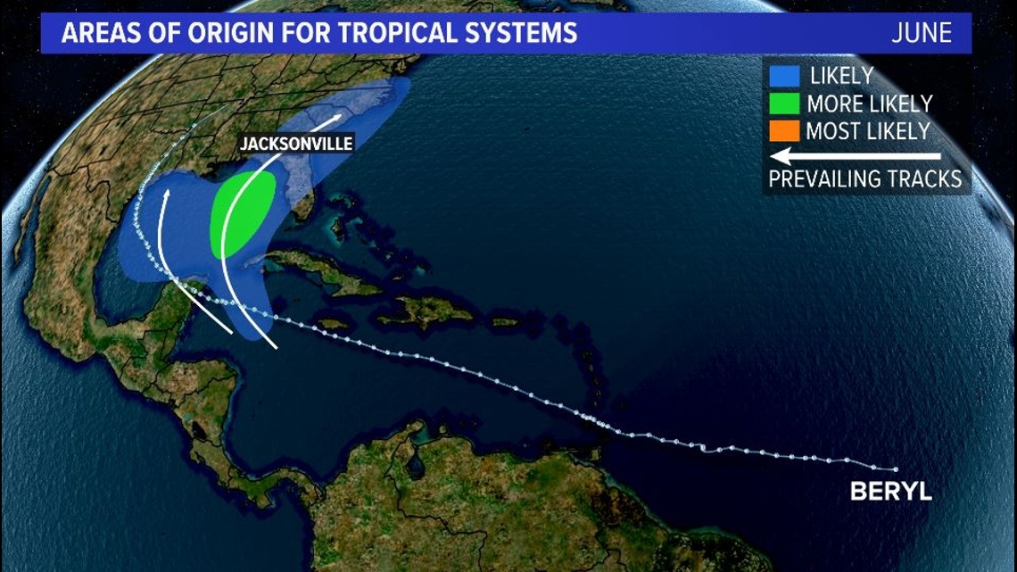
Beryl became the earliest Category 4 and Category 5 hurricane to form in the Atlantic on record (which dates back to 1851). It was also the strongest June and July hurricane ever recorded.
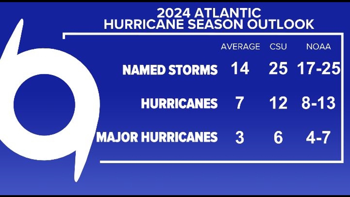
On Tuesday, July 9, a respected group of scientists at Colorado State University who give hurricane season predictions, increased their seasonal outlook. They bumped their expected number of named storms from 23 to 25, hurricanes from 11 to 12, and major hurricanes from 5 to 6. These numbers, as well as the outlook from NOAA, greatly exceed the average.

The peak of hurricane season is still two months away. The Most Accurate Weather Team will be here all season keeping you updated.

