JACKSONVILLE, Fla — Every year, folks anticipate NOAA's seasonal outlook for winter just like they do the outlook ahead of the Atlantic hurricane season. On Thursday, October 21, the Climate Prediction Center announced the U.S. temperature and precipitation outlook for winter, extending from December 2021 through February 2022.
Where has the year gone? We digress...
During the winter outlook announcement, NOAA forecasters also discussed the ongoing drought in the western U.S. and announced the seasonal Drought Outlook for the season ahead.
As expected, above-average temperatures are favored across the South and most of the eastern U.S. as La Niña climate conditions have emerged. This is the second winter in a row with a La Niña pattern.
On the other hand, below-average temperatures are favored for southeast Alaska and the Pacific Northwest eastward to the northern Plains.
In addition, drier-than-average conditions are favored across the Southeast, the Southwest, and in southern California and south-central Alaska.
Wetter-than-average conditions are expected across portions of the Northern U.S., primarily in the Pacific Northwest, northern Rockies, Great Lakes, Ohio Valley, and western Alaska, according to NOAA.
“Using the most up-to-date observing technologies and computer models, our dedicated forecasters at the Climate Prediction Center produce timely and accurate seasonal outlooks to help communities prepare for the months ahead,” said Michael Farrar, Ph.D., director of the National Centers for Environmental Prediction.
Widespread severe to exceptional drought continues to dominate the western half of the continental U.S., Northern Plains, and the Missouri River Basin. Drought conditions are forecast to persist and develop in the Southwest and Southern Plains. The Pacific Northwest, northern California, the upper Midwest, and Hawaii are most likely to experience drought improvement.
This comes to no surprise.
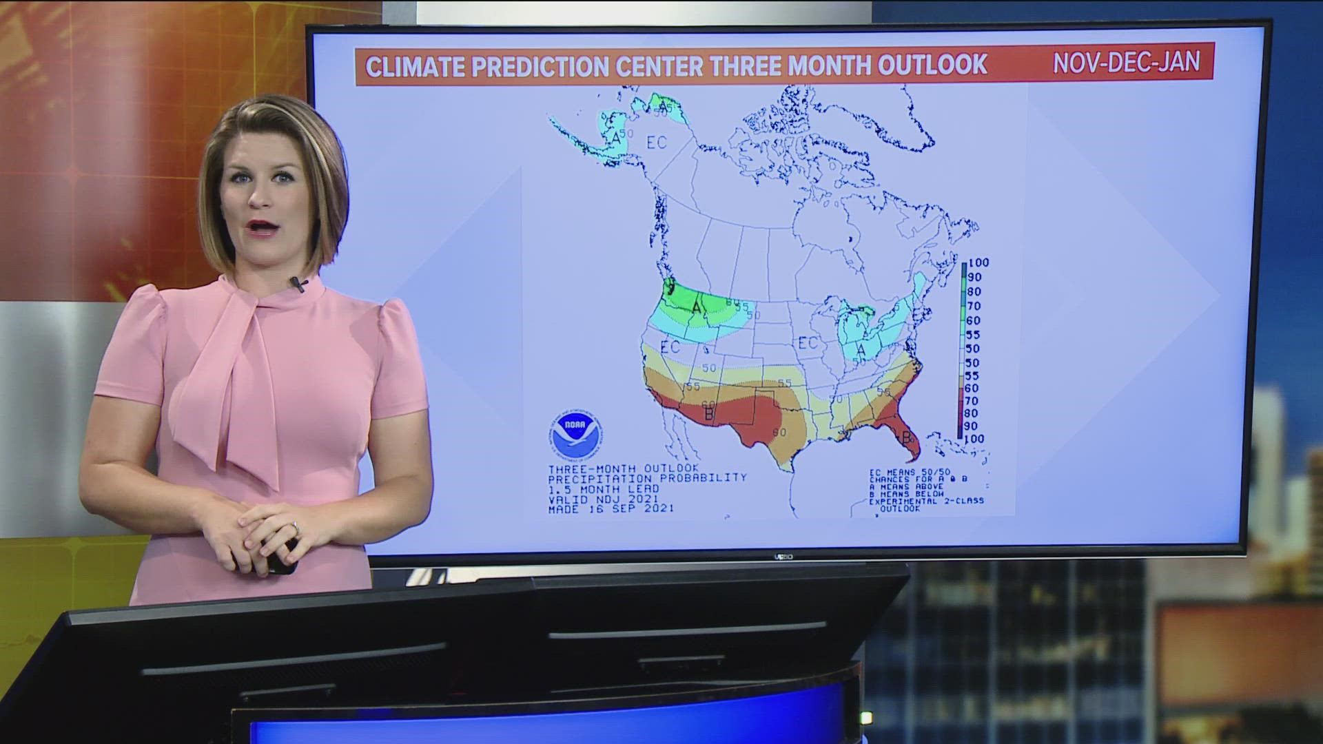
In September, the CPC issued the three-month outlook for November-December-January. This showed below average precipitation and above average temperatures for the Southeast, especially so across the First Coast in southeast Georgia and northeast Florida.
Then, just recently, the CPC issued a La Niña Advisory for the upcoming winter season stating, "La Niña conditions have developed and are expected to continue with an 87% chance of La Niña in December 2021- February 2022."
In short, La Niña conditions during the winter months typically shift the jet stream across the United States farther north, which leads to an overall drier and warmer pattern across the Deep South through the Southeast.
This doesn't mean the Jacksonville area won't see Arctic air intrusions with some brutally frigid cold snaps this winter. However, it hints at our average precipitation to be a bit lower than normal and average temperatures to be a bit warmer than normal as a whole.
NOAA produces seasonal outlooks to help the nation prepare for weather and climate that is likely to come during the next few months, to minimize negative impacts on lives and livelihoods. Empowering people with the information they need to take action to protect themselves is key to NOAA’s effort to build a Weather-Ready Nation.

