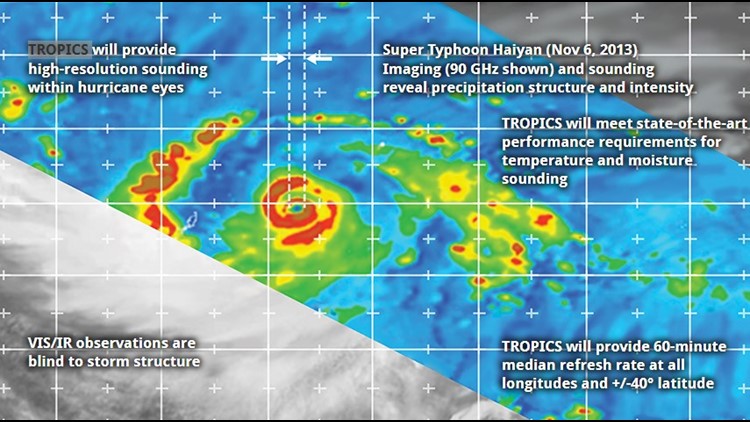
JACKSONVILLE, Fla. — The latest forecasting tool from NASA was launched out of New Zealand May 7th to help meteorologist forecast tropical weather. Because forecasting the tropics can be difficult. This new satellite called Time Resolved Observations of Precipitation Structure and Storm Intensity with a Constellation of Smallsats… also known as TROPICS will hopefully help make forecast more accurate.
The satellite will provide rapid refresh microwave measurements over the tropics that can used to observe temperature and rainfall with a storm over it’s entire life cycle. What is interesting its combed of not only one but a constellation of cube sats in low earth orbit. Right now, we have satellite imagery that can do this, but the data is not continuous. With the constellation it will be a large leap forward on a global scale for this information.


With more and more storms undergoing rapid intensification with warming oceans this data will be critical in figuring out what and when that is occurring.
Speaking of global, of course it will be useful here in the Atlantic but also around the world. Especially in those areas that don’t have the luxury of Hurricane Hunters like we do here in the United States.
Hurricane season is less than a month away, don’t forget our First Coast News Hurricane Special Airs on June 1st. It only takes one storm so lets make sure we are ready for this upcoming season.


