JACKSONVILLE, Fla. — On Thursday, the Climate Predication Center announced that La Nina conditions have developed and will continue through the winter. This is in fact the second year in a roll the La Nina will be taking place as temperatures in the Western Pacific Ocean continue to remain above average. Now what exactly does that mean and how does it impact our weather?
The La Nina is a part of the ENSO or the El Nino Southern Oscillation cycle, a natural pattern that cycles from warm and cool phases in the Pacific Ocean. Very simplified LA Nina is above average temperatures in the western pacific caused by an increase in the trade winds across the pacific with below-average temperatures in the eastern pacific.
I know this is far away and we may not think it impacts us directly but the earth's climate is a closed system. A large change in one part of it influences other areas.
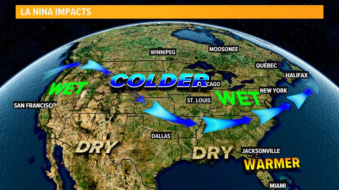
This change often causes a variable jet stream which can lead to big changes in temperatures and rain patterns here in the USA. For example, in the Pacific North West, an increase in rain and above-average snowfall often occurs. This increase in the variable Jet Stream Pattern is also known to Meteorologists as a positive North Atlantic Oscillation.
For us here on the First Coast, we can expect above-average temperatures and below-average rainfall during a La Nina Pattern.


That is just on average and of course, small-scale features can bring us a change in the pattern, but of course, it is one of the many factors we look at when making a long-term extended forecast.

