JACKSONVILLE, Fla. — For the latest on all tropical developments we're currently monitoring, click here.
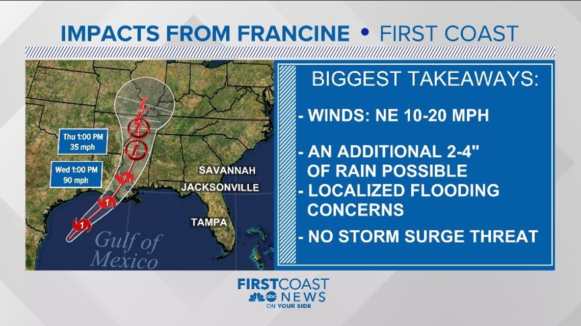
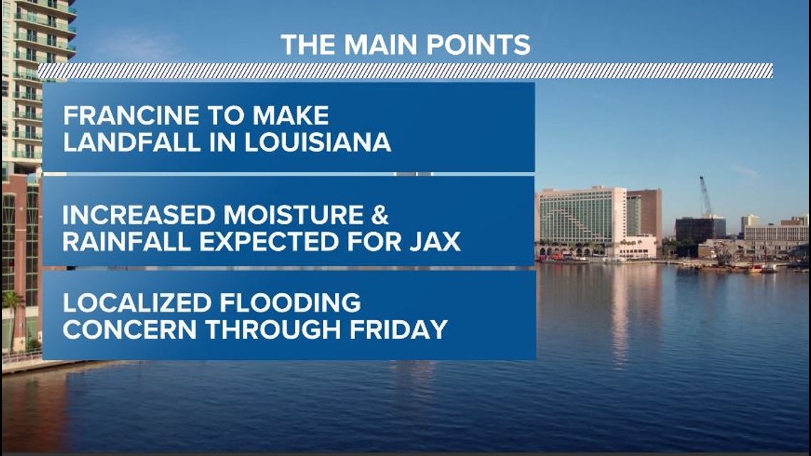
Francine will push plenty of tropical moisture toward northeast Florida and southeast Georgia over the next several days.
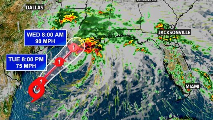
Easterly flow will continue to feed into Francine's core well off to the west of Florida, however these onshore winds for the First Coast will keep us breezy and will continue to pull in coastal showers through the morning hours Wednesday and Thursday.
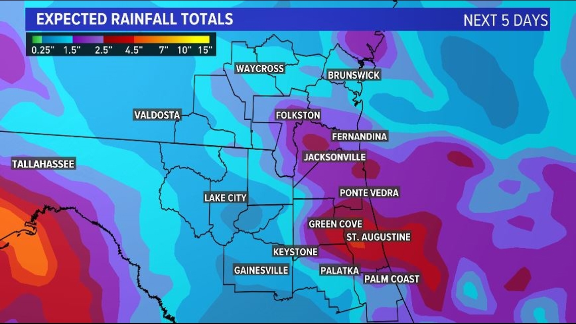
Many of these rain bands could be narrow in nature, but remain over the same locations for long periods of time, leading to a very localized flooding threat for some areas.
By the afternoon and evening, most storm and shower activity will stay south of I-10 in northeast Florida. With high volumes of rainfall having been seen in some locations over the past week, flash flooding will be the primary concern.
By Friday, Francine will begin to move into the Mississippi River Valley, lifting a warm front on the eastern side of the storm northward right over the First Coast. This will likely bring another round of widespread rainfall on Friday, before slightly drier air will wrap back around the storm just in time for the weekend. Showers will still be possible, but overall rain chances will be much lower.
The big takeaway? Francine will supply the First Coast with more rain, storms & localized flooding concerns through the end of the work week. Strong winds and dangerous storm surge will not be expected here.