x
Breaking News
More () »

LIVE CAMERAS: Watch Hurricane Milton as it nears Florida landfall

Tampa is bracing for Milton's landfall. Track the storm live on these web cameras.

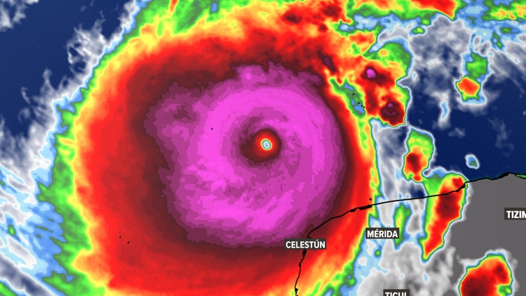
TAMPA, Fla. — Hurricane Milton is forecasted to make landfall on Wednesday night as a major storm, despite fluctuating between a Cat 5, Cat 4, and Cat 3.

As of the latest advisory from the National Hurricane Center, the Tampa Bay area is expected to see between 10 and 15 feet of storm surge. Rainfall from Milton is expected to range between 5-12 inches with localized totals up to 18 inches across portions of the Florida Peninsula and the Keys through Wednesday night.

TRACKING MILTON: Spaghetti models, forecast cones, alerts and more

As the storm draws closer to Florida's coast, numerous live cameras are tracking its movement throughout the state, a list of which can be found below.

Hurricane Milton live cameras in Florida

The University of Tampa - Riverfront Webcam

Clearwater Pier Beach Tampa Bay 

EarthCam Live: Hurricane Milton (Naples)

Sunset Terrace at Margaritaville Beach Resort Fort Myers Beach

Intracoastal Waterway Venice Nokomis Florida

Milton came on the scene on Saturday as a tropical storm. Early Monday morning, Milton kicked off a rapid intensification starting as a Category 2 storm. By noon, the storm had strengthened to a large Category 5 hurricane.

Florida could see impacts beginning Tuesday evening into Wednesday.

As of the latest advisory, the storm is about 560 miles southwest of Tampa with maximum sustained winds at 155 mph. Earlier on Monday, Milton had maximum sustained winds of 180 miles per hour.

It is moving east-northeast at 12 mph.

"While fluctuations in intensity are expected, Milton is forecast to remain an extremely dangerous hurricane through landfall in Florida," the  National Hurricane Center said. 

Before You Leave, Check This Out