JACKSONVILLE, Fla. — This story is no longer being updated. For the latest weather stories on the First Coast, click here.
Here are the latest tropical track and satellite radar associated with Helene.
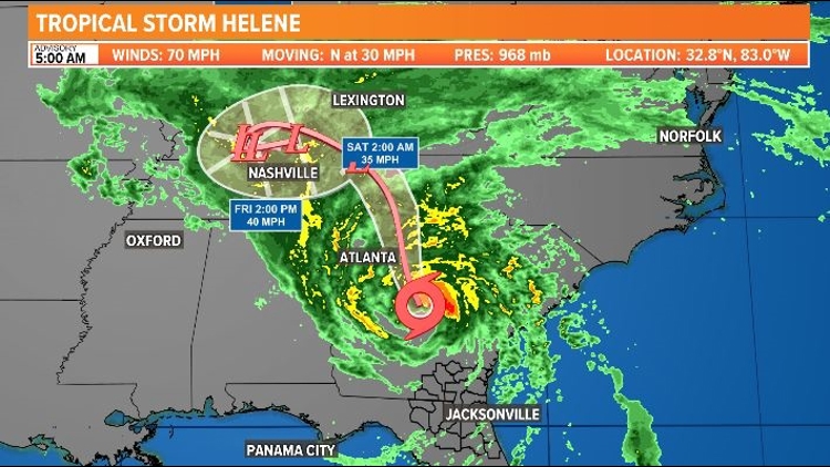
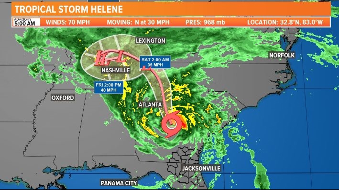
Tropical Track
This is the latest forecast cone, which shows an area where the center of the storm could go, when and how strong it might be at the given time.

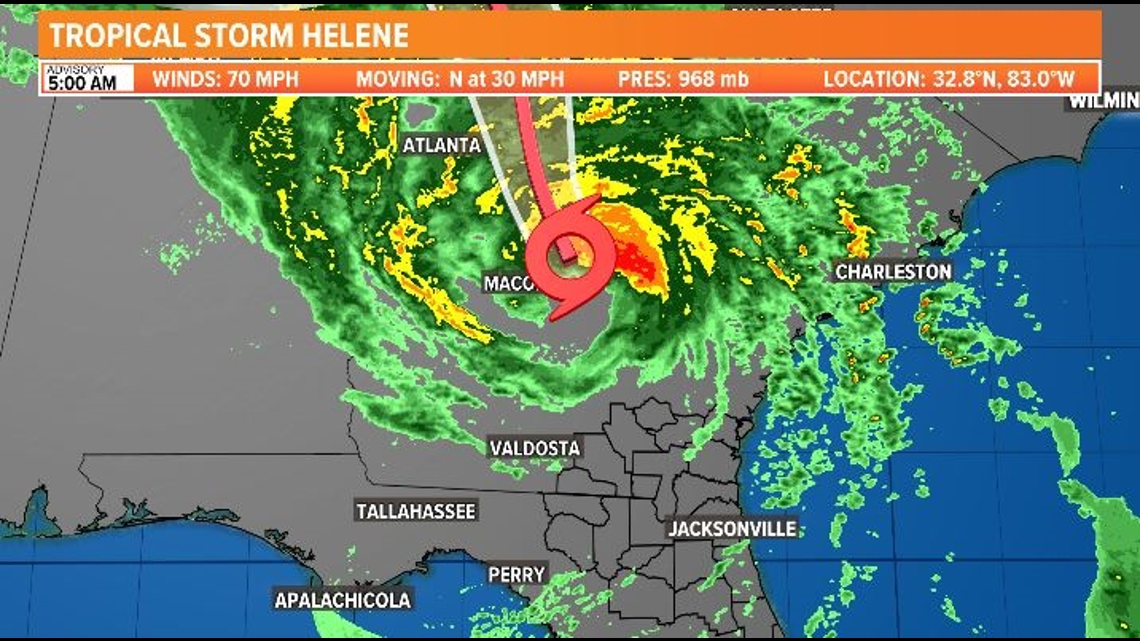

Interactive Radar
The latest satellite and radar image for the Gulf of Mexico, the Caribbean Sea and the Atlantic Ocean.
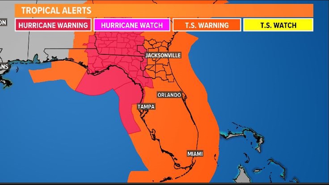
Watches and Warnings
Here are the watches and warnings that have been issued ahead of the storm.

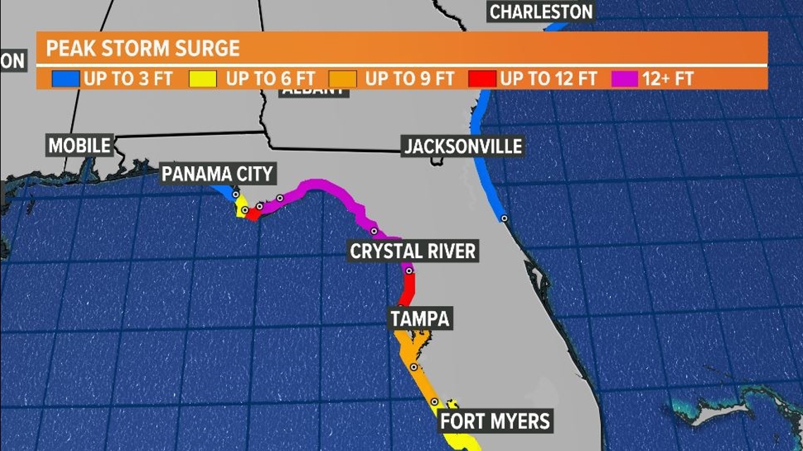
Peak Storm Surge

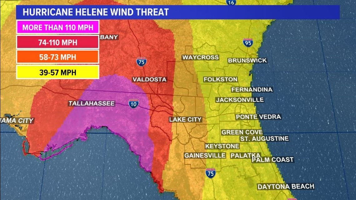
Estimated Hurricane Helene Wind Speeds