JACKSONVILLE, Fla. — On Monday, around 3:32 a.m., a brief tornado touched down in Putnam County. However, nobody saw the tornado as it was the middle of the night and in a rural area. So how did the National Weather Service confirm it took place?
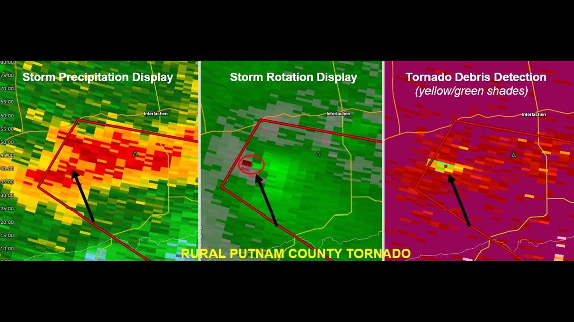
This graphic below shared by the Jacksonville NWS shows several different forms of radar products.
One is your classic reflectivity we often show. One is your velocity which shows wind to and from the radar, we often show this in tornado warnings as it gives you an idea of where rotation is.
The last one on the right is correlation coefficient.
Simply this image shows us stuff that is in the atmosphere that shouldn’t be. That is because the radar can look out and tell if something it is “seeing” is meteorological or not meteorological, like debris.


Each of these products alone can not confirm a tornado on the ground, especially since the radar beam that far away from the radar site is several thousand feet in the air and can not see what is taking place on the ground. But with three of them combined all indicating rotation and debris in the atmosphere you can infer a tornado did in fact take place.
Since there was no damage reported it will likely go down as being rated and EF-0 as well. But we know a tornado took place for a few reasons.
So next time we have severe weather if you want to be a weather forecaster with us these are some of the things you need to look for.


