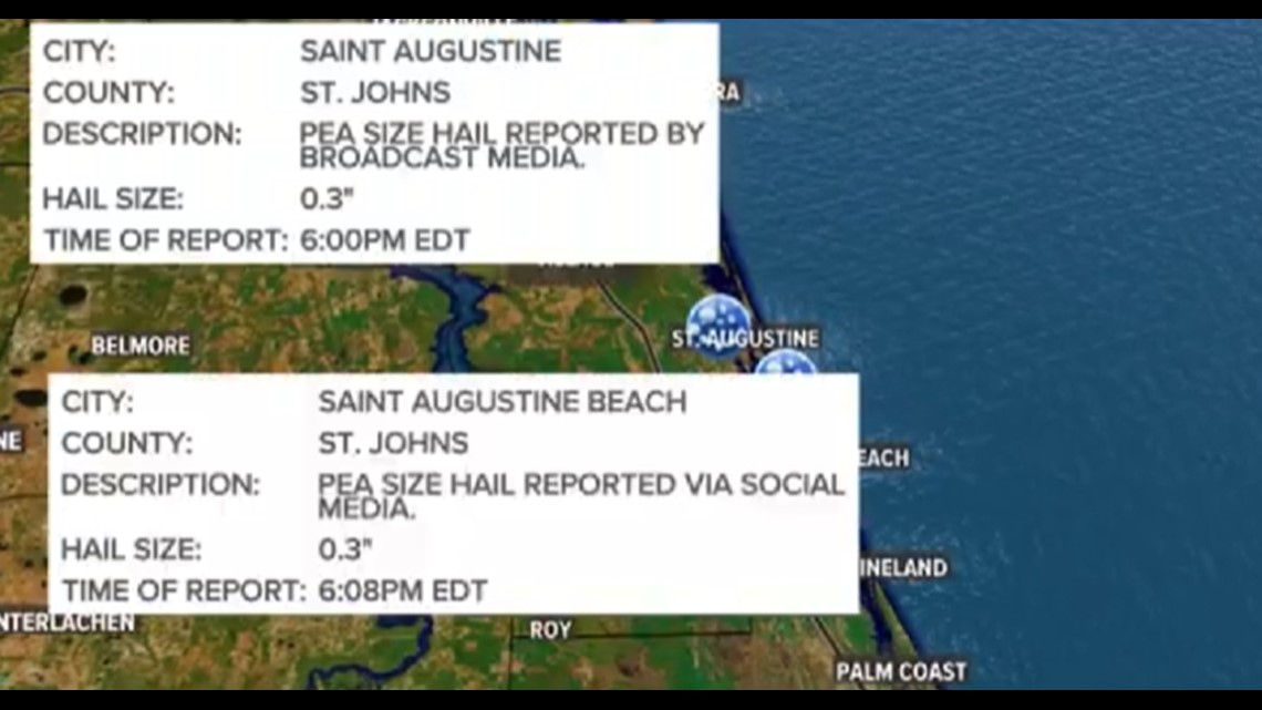
JACKSONVILLE, Fla. — On March 28th, hail was reported from Nassau to St. Johns County as severe thunderstorms rolled across the First Coast. Yet the high temperatures in the impacted areas were well into the 80s - How did ice fall from the sky?
It all has to do with the height of the freezing level in a thunderstorm and just how strong that storms updraft is.


Hailstorms are formed when raindrops are carried upwards in a thunderstorm. Since air cools as it rises, it reaches the freezing point and freezes.
As the hailstone falls, it collides with water drops which either can freeze on contact or stick to its surface and freeze as the hailstone is carried again aloft within a thunderstorm updraft. The stronger the storm the more this process is repeated and thus the larger the hailstone.
The hail falls to the ground when it’s weight and the force of gravity become stronger than the storms updraft.


The largest hailstone on record was found in 2010 in South Dakota. It was 8 inches in diameter, which is as big as a bowling ball.
In Florida, despite the state having the most thunderstorms in the USA the freezing level is often to high to support large hail formation - But with extra strong storms it can still occur.
If you want to report hail, there is a way you can estimate it’s size by using familiar objects.
Pea = 1/4 inch diameter
Mothball = 1/2 inch diameter
Penny = 3/4 inch diameter
Nickel = 7/8 inch
Quarter = 1 inch — hail quarter size or larger is considered severe
Ping-Pong Ball = 1 1/2 inch
Golf Ball = 1 3/4 inches
Tennis Ball = 2 1/2 inches
Baseball = 2 3/4 inches
Tea cup = 3 inches
Softball = 4 inches
Grapefruit = 4 1/2 inches
If you want to share photos of hail or any kind of severe weather please share them with us on the First Coast News App by using the near me function or via the First Coast News Weather Watchers Facebook Page.

