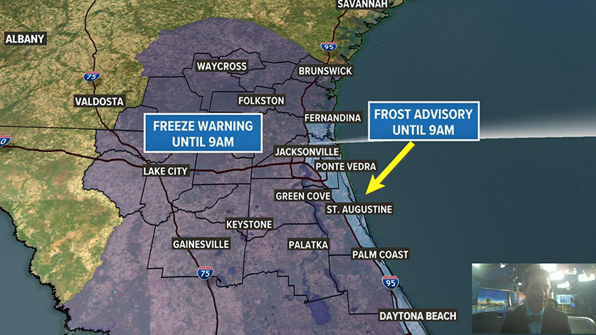
JACKSONVILLE, Fla. — It was a Winter Wonderland across all of Jacksonville this morning -- from the Suwannee to the sand!
There was frost reported all the way to the coast and even inland temperatures in the mid-20s. Can you say... #FCNBrrr!
Also, goodbye for now mosquitoes!
This cold weather has made quite an entrance this January after a record warm December. We were due for some chilly air. Our "average" in Jacksonville for late January is 43F for a low and 66F for a high.
Since then, the same location has reported three additional freezes -- January 19, January 23, and January 24.
This is far below "normal," but Mother Nature is catching up for sure. Jacksonville may pick up two, maybe three, more freezes in the next week with below normal temperatures expected through the weekend. At the very least, inland freezes will be possible both Friday night and Saturday night.
So far, this cold has come with dry air keeping the wintry precipitation to our north. We'll have to keep an eye on things to see if that is the case this weekend or not!
As the calendar turns to February, the pattern looks to moderate with warmer temperatures in store for the First Coast overall.
The climate data for Jacksonville has been kept since 1871 with numbers being recorded at the Jacksonville International Airport location since 1971.

