JACKSONVILLE, Fla. — The First Coast has had a nice taste of September weather in the past few days thanks to slightly lower humidity and pleasant breezes. But, if you look to the sky this afternoon you may notice the sky seems a bit hazier.
Upper level winds have carried wildfire smoke from thousands of miles away, originating across the Western U.S., all the way to the East Coast.
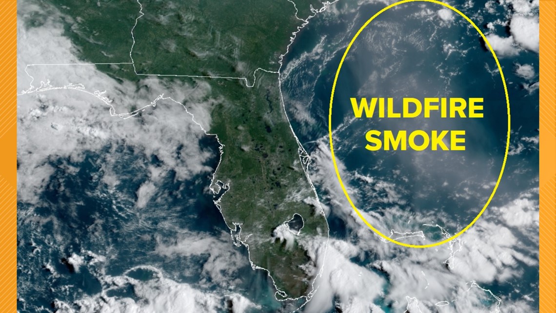
Sometimes, if the smoke is dense enough, there can be a concern for air quality issues. This time around, the Jacksonville area is not seeing any drop in air quality. The smoke will instead bring us more vivid colors in the sky during sunrise and sunset. Between the cumulus during the day, you may even notice a hint of light tan or grey. If it's not visible to the naked eye, then you can clearly view the smoke from the satellite imagery across the Southeast.
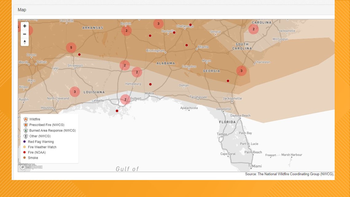
The National Wildfire Coordinating Group (NWCG) along with the Wildland Fire Support also indicate the smoke on their maps. First Coast News Weather Watchers also noticed the pop of color in the sky on Monday morning. Many images were posted in the Facebook group showing bright pinks and oranges in the sky.

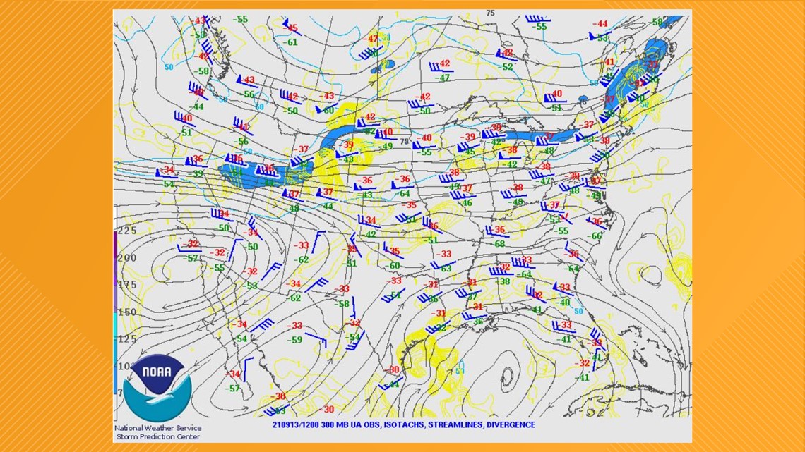
The jet stream map at 300 millibars shows the strong flow from west to east, which is why this smoke has traveled all the way to the East Coast. An air pressure of 300 millibars is said to occur near 30,000 feet (9,100 meters) in elevation. But the height ranges from near 27,000 to 32,000 feet (8,200 to 9,600 meters) across the United States.

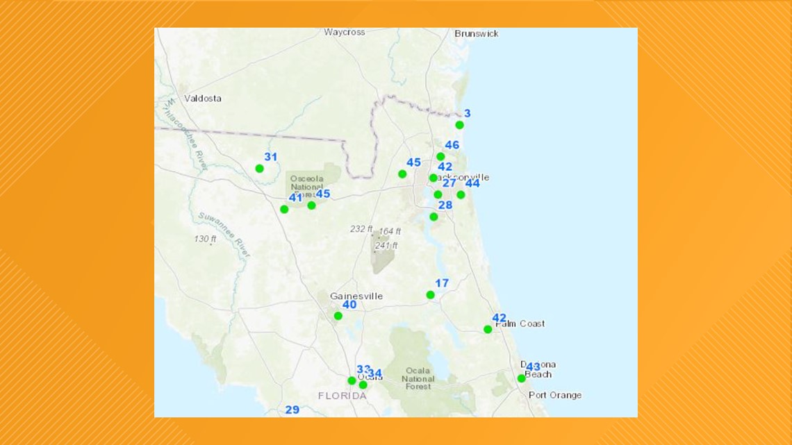
Below is the air quality map showing "GREEN" across the entire First Coast.

Smoke shown below reaching the First Coast and majority of the Southeast!

