JACKSONVILLE, Fla. — The atmosphere around the globe despite being separated by large distances is still connected. The cliché saying a butterfly can flap its wings on the other side of the world and cause a hurricane here does have an element of truth to it.
For the latest look at tropical systems in the Atlantic visit here.
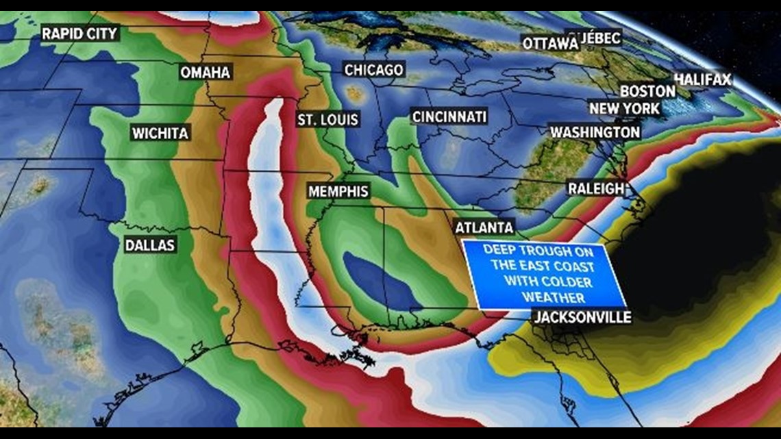
Through mid-October a typhoon (a hurricane in the western Pacific) on the other side of the world is causing a cold snap on the First Coast thanks to this “butterfly effect” and global fluid dynamics.

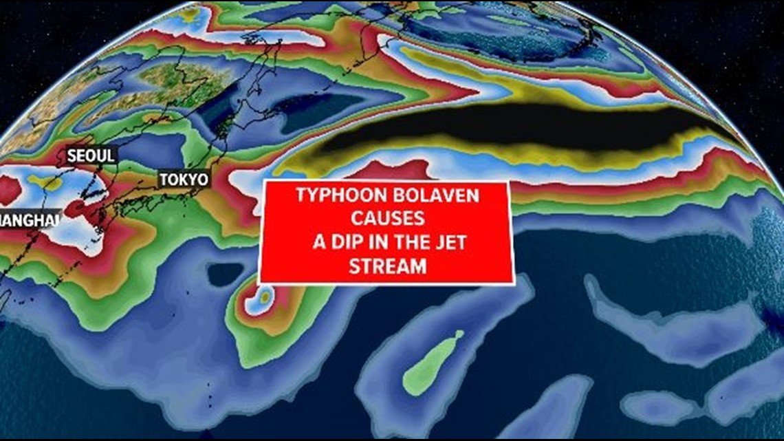
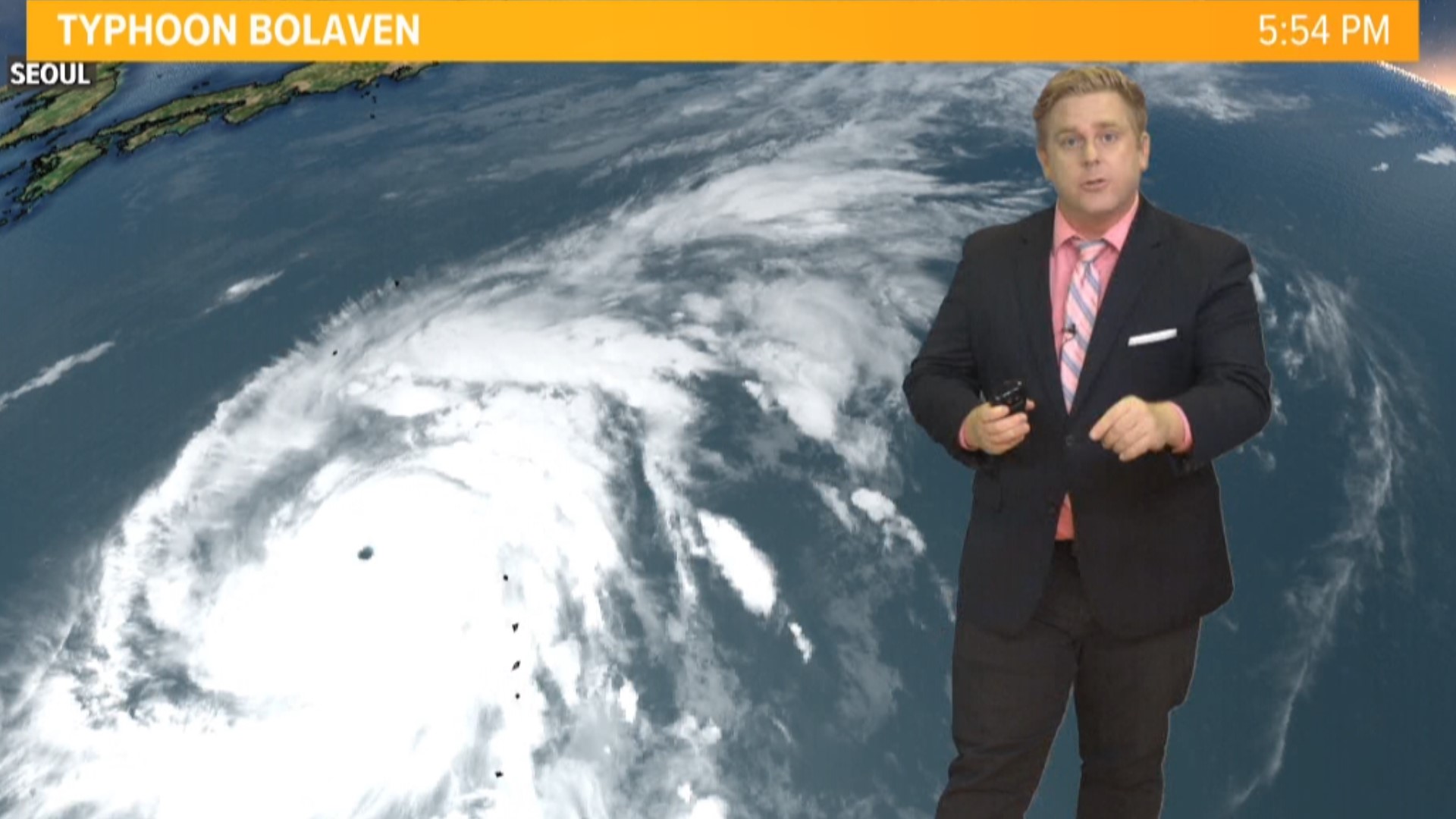
The storm is Typhoon Bolaven which peaked near Guam as a Category 5 storm. This is now pulling northeast of Japan and as it does so it is interacting with the Jet Stream causing it to dip and pull south. This interaction much like snapping a rope is causing a ripple effect downstream.
Starting with with a deepening trough south of Japan from the storm, behind that a ridge will set up with another trough south of Alaska, in the United States a ridge over the weekend and early next week on the west coast will create above-average temperatures and thus a snap behind that will cause a big dip in the jet stream for the east coast including Jacksonville and the First Coast. Resulting in some of the coolest weather since early spring.