JACKSONVILLE, Fla. — Be a meteorologist with us this hurricane season! Here's a quick lesson, or maybe a refresher for some, on commonly used terms during hurricane season.
Tropical storm: A tropical cyclone in which the maximum sustained surface wind speed (using the U.S. 1-minute average) ranges from 34 kt (39 mph or 63 km/hr) to 63 kt (73 mph or 118 km/hr).
Tropical storm warning: An announcement that sustained winds of 34 to 63 knots (39 to 73 mph or 63 to 118 km/hr) are expected somewhere within the specified area within 36 hours in association with a tropical, subtropical, or post-tropical cyclone.
Hurricane: A tropical cyclone in which the maximum sustained surface wind (using the U.S. 1-minute average) is 64 kt (74 mph or 119 km/hr) or more. The term hurricane is used for Northern Hemisphere tropical cyclones east of the International Dateline to the Greenwich Meridian.
Hurricane Warning: An announcement that sustained winds of 64 knots (74 mph or 119 km/hr) or higher are expected somewhere within the specified area in association with a tropical, subtropical, or post-tropical cyclone. Because hurricane preparedness activities become difficult once winds reach tropical storm force, the warning is issued 36 hours in advance of the anticipated onset of tropical-storm-force winds. The warning can remain in effect when dangerously high water or a combination of dangerously high water and waves continue, even though winds may be less than hurricane force.
Hurricane Watch: An announcement that sustained winds of 64 knots (74 mph or 119 km/hr) or higher are possible within the specified area in association with a tropical, subtropical, or post-tropical cyclone. Because hurricane preparedness activities become difficult once winds reach tropical storm force, the hurricane watch is issued 48 hours in advance of the anticipated onset of tropical storm force winds.
Tropical wave is a term you hear frequently before a storm forms.
- A tropical wave is an unorganized area of storms traveling west out of Africa. These are important to follow because around 85% of major hurricanes begin as tropical waves.
Another common term you hear is Invest.
- Invest stands for "investigative area." When a tropical wave becomes more organized, the National Hurricane Center will designate the area of disturbed weather as an invest. Each invest is given a number from 90 to 99. For example, Invest 90L. The L tells us the system is in the Atlantic. This also allows the NHC to run ensemble models, or spaghetti models, on these systems.
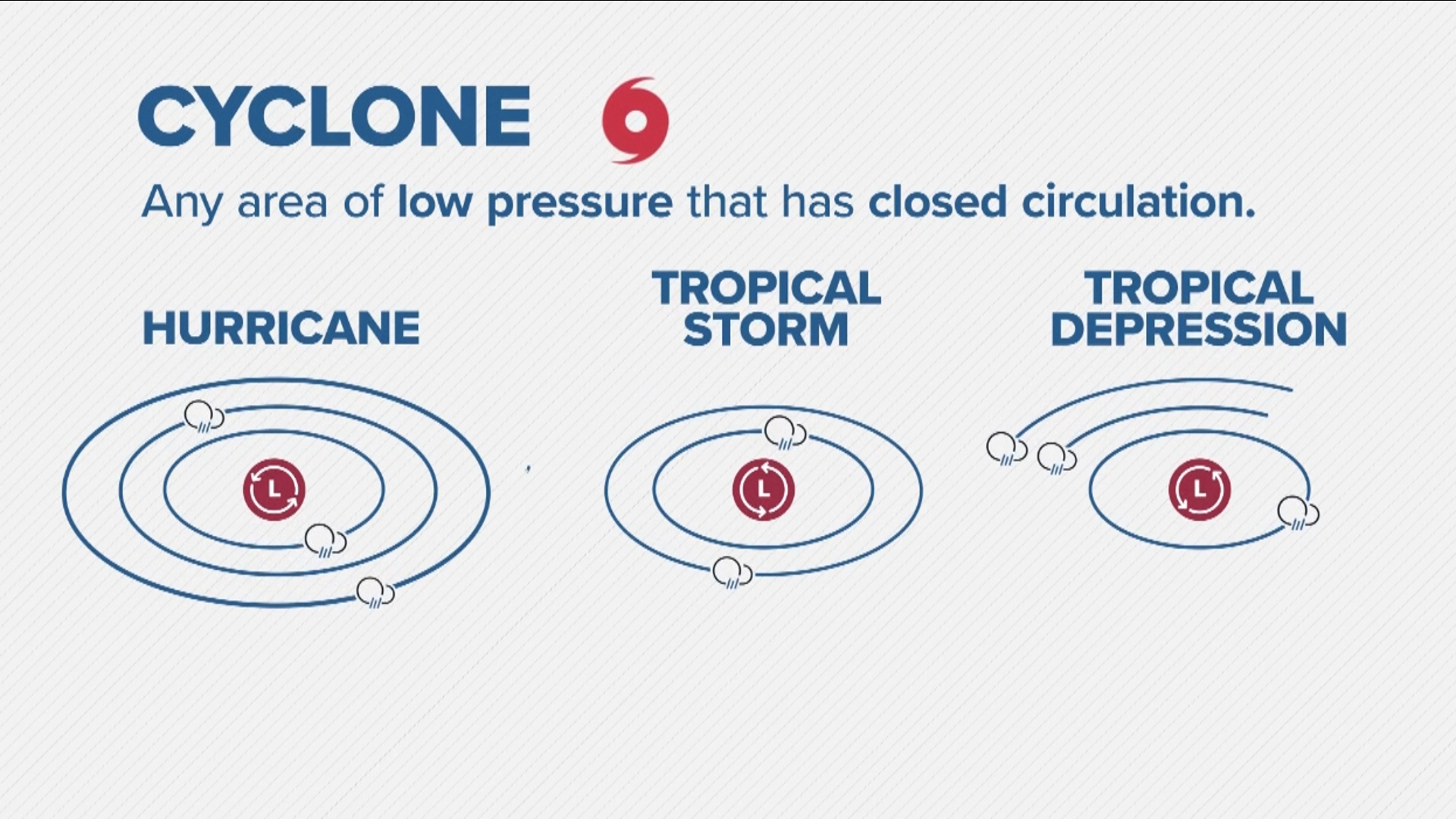
You might also hear the term cyclone during hurricane season.
- A cyclone is a blanket term for any area of low pressure that has a closed circulation. Hurricanes, tropical storms, and tropical depressions are all cyclones because they are closed areas of low pressure. Typhoons are also cyclones, but are just given a different name.
Other commonly used terms:
Eye:
- The roughly circular area of comparatively light winds that encompasses the center of a severe tropical cyclone. The eye is either completely or partially surrounded by the eyewall cloud.
Center:
- Generally speaking, the vertical axis of a tropical cyclone, usually defined by the location of minimum wind or minimum pressure. The cyclone center position can vary with altitude. In advisory products, refers to the center position at the surface.
Rapid Intensification:
- An increase in the maximum sustained winds of a tropical cyclone of at least 30 kt in a 24-h period.
Storm Surge:
- An abnormal rise in sea level accompanying a hurricane or other intense storm, and whose height is the difference between the observed level of the sea surface and the level that would have occurred in the absence of the cyclone. Storm surge is usually estimated by subtracting the normal or astronomic high tide from the observed storm tide.

