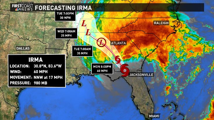
JACKSONVILLE, Fla. --Tropical storm Irma is now racing away and continues to weaken. Here on the First Coast a Tropical Storm Warning remains in effect. That being said though, weather conditions are improving. Dry air being wrapped around the storm is pushing into the region. This will keep wind gusts in the area around 35 to 40 mph into the late afternoon, before weakening further into the night.
Flash Flood Warning is in effect for the entire St. Johns River basin through 6:15pm Monday. There's a triple impact on the river. A combination of tremendous rainfall, storm surge and a rising high tide will cause the river to overflow it's banks and flood neighborhoods and streets along the St. Johns River. The river is being bottlenecked near the Main Street Bridge and have a difficult time draining as the tide rises down the river.
Flooding of rivers, streams and creeks are a big concern. The amount of rain the First Coast has received will take time to flush into these outlets. So expect the levels of rivers, creeks and streams to continue to rise over the next few days. It's likely they'll begin to subside and drain after Wednesday this week.
Street flooding continues to be an issue across the First Coast but will begin to subside now that the rains have passed. Bulk of the storm surge is lingering but dwindles through the night.
Tornado and flooding rain threats are over, and some sunshine will filter into the area.


