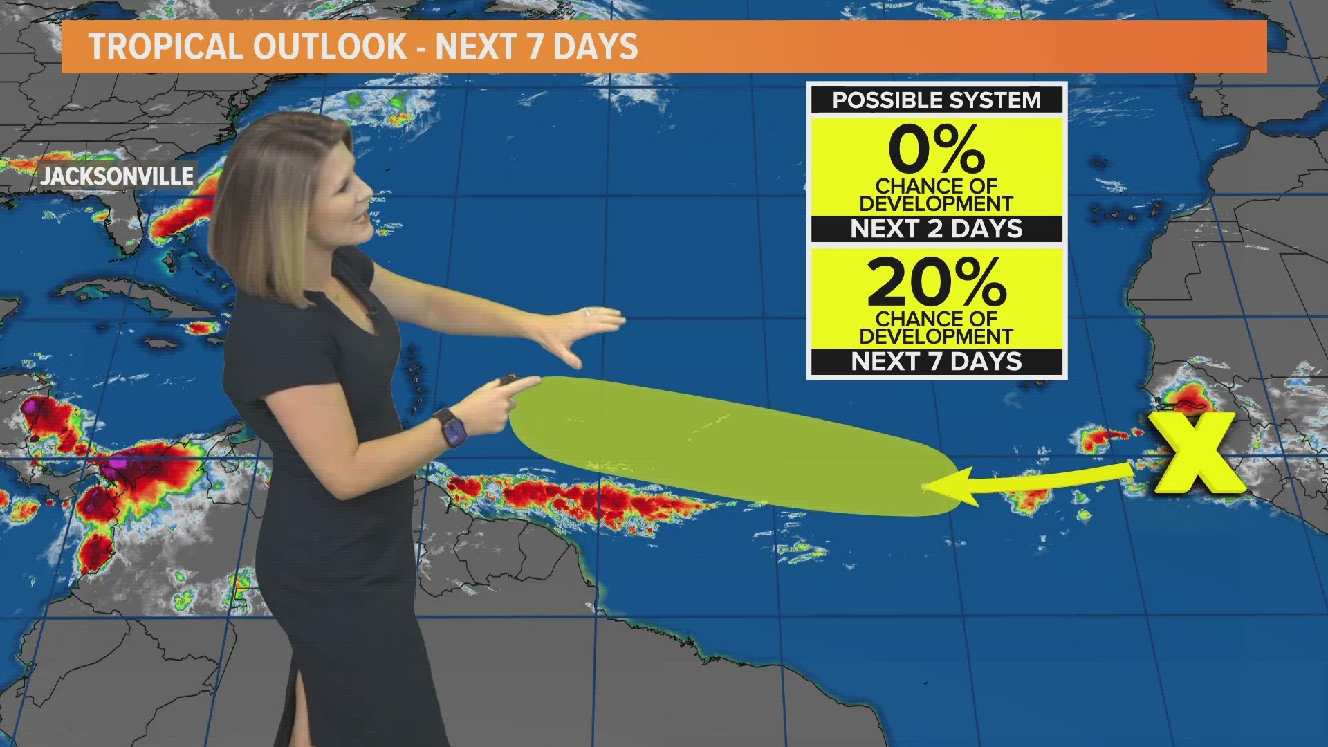
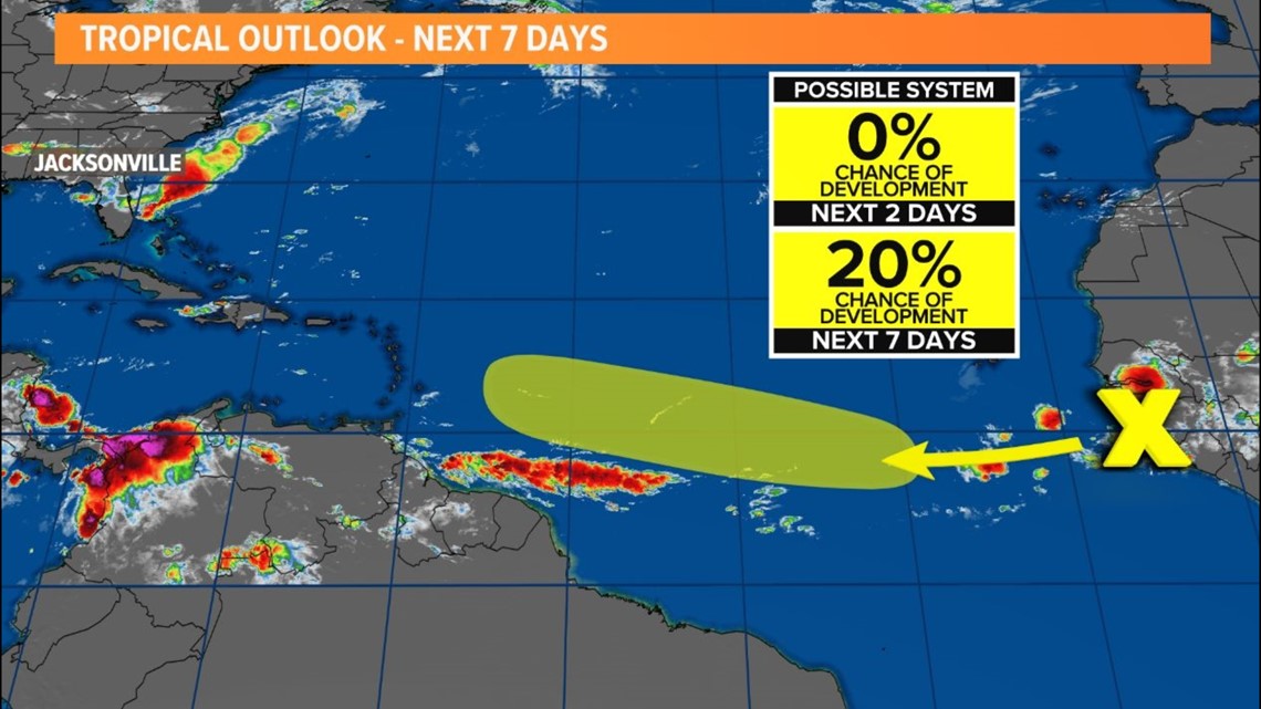
JACKSONVILLE, Fla. — There are no threats to the First Coast in the next 7 days, but the National Hurricane Center is highlighting an area in the tropical Atlantic for a low chance of development.
In an area that's more of an August hot spot versus June, a tropical wave is forecast to move off the west coast of Africa later today and early Friday. Environmental conditions are expected to be conducive for the gradual development of this system while it moves generally westward across the eastern and central Atlantic during the early to middle part of next week.
Stay tuned for forecast updates.
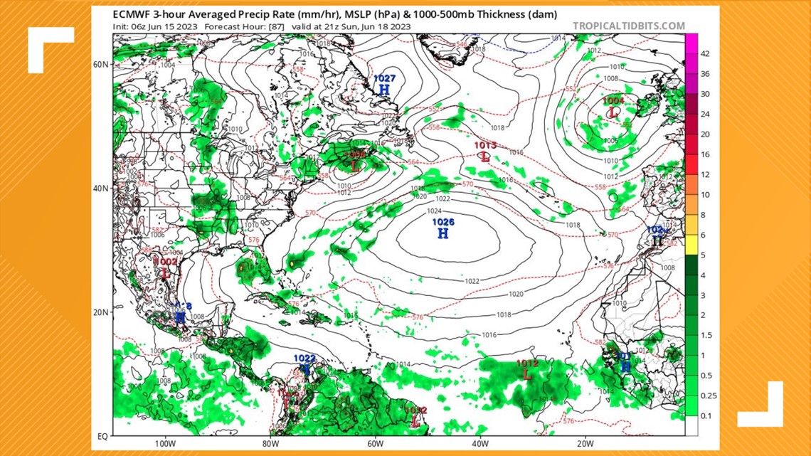
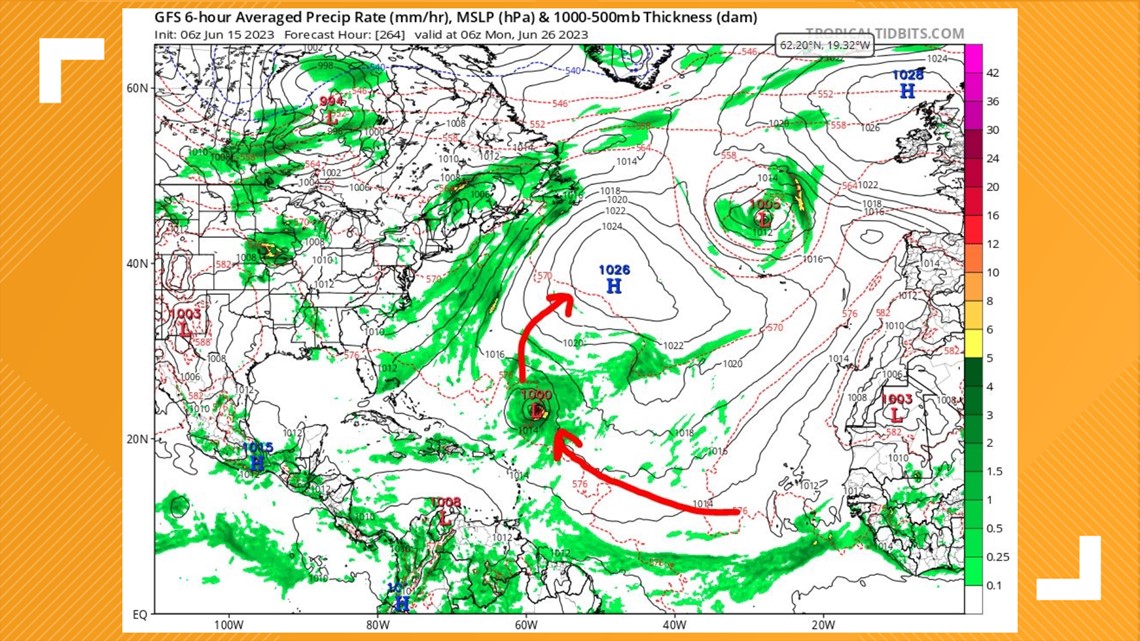
The GFS (American) computer model, and history, suggest that if a cyclone does develop it would be likely to recurve out to sea - a "fish storm" as meteorologists nickname systems as such. However, Elsa was an outlier in 2021 defeating the odds and surviving across the Atlantic, and the European computer model shows tropical energy headed into the Caribbean in the next week plus.

Here are two of the most recent computer model runs (Euro and GFS) as of Thursday morning. The Euro shows a much weaker system by this weekend pushing west. The GFS shows a consolidated tropical cyclone recurving across the open Atlantic by June 26. Remember, these images are guidance and not a forecast.


How unusual is tropical formation in this part of the Atlantic in the month of June?
According to historical data of tropical and subtropical formation points, only three June tropical cyclones have formed inside the yellow hatched area from the NHC's 8 a.m. tropical weather outlook on Thursday, June 15. The last to form in the area was Elsa in 2021, which eventually impacted the First Coast.
Why are we seeing a tropical wave off Africa this early in the season?
Seasonal outlooks have called for a "near normal" Atlantic hurricane season, but situations like this and data showing our oceans are seeing a heat wave are complicating that forecast. Bottom line is there's plenty of energy across the Atlantic basin for thunderstorms to develop and sustain themselves. Despite the El Nino pattern, there has been less wind shear thanks to a weaker subtropical high and an observed low concentration of Saharan dust.
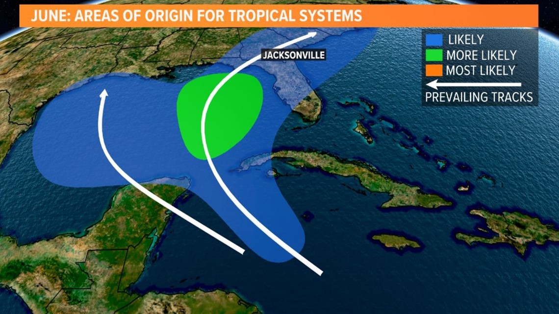
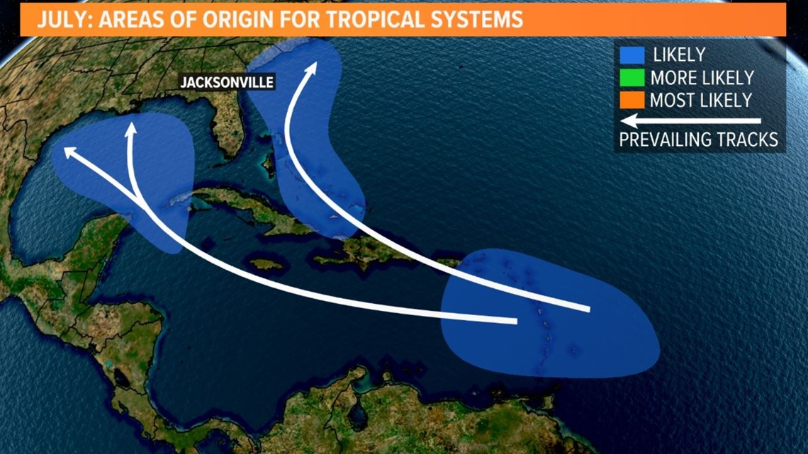
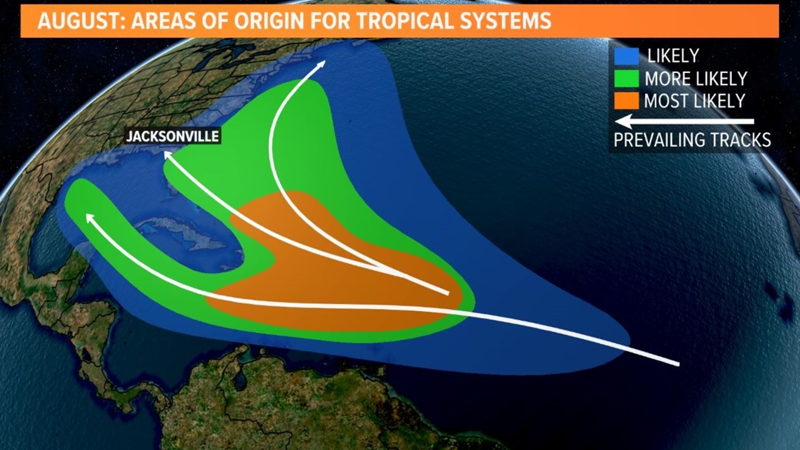
Where do we normally see storms develop in June?
The Caribbean Sea is a more typical hot spot for the month of June. Even by July, African tropical waves are not common. The "African tropical train" as meteorologists call it usually doesn't get rolling until August.



NOAA is forecasting 12-17 named storms, 5-9 hurricanes, and 1-4 major hurricanes for the 2023 Atlantic hurricane season. The 30-year average calls for a season with 14 named storms, 7 hurricanes, and 3 major hurricanes.
Therefore, NOAA is calling for a near-normal 2023 Atlantic hurricane season.
If you live in a hurricane-prone area, it's best to always be prepared and know what hazards could affect you and your family.
The NHC's regular tropical weather outlooks come out regularly on the 2s and 8s during the season.
-------------------------------------------------------------------
If you missed our annual hurricane special, you can catch it here on YouTube. This year, we're hearing from our neighbors in "Hurricane Ready 2023: It Only Takes One."

