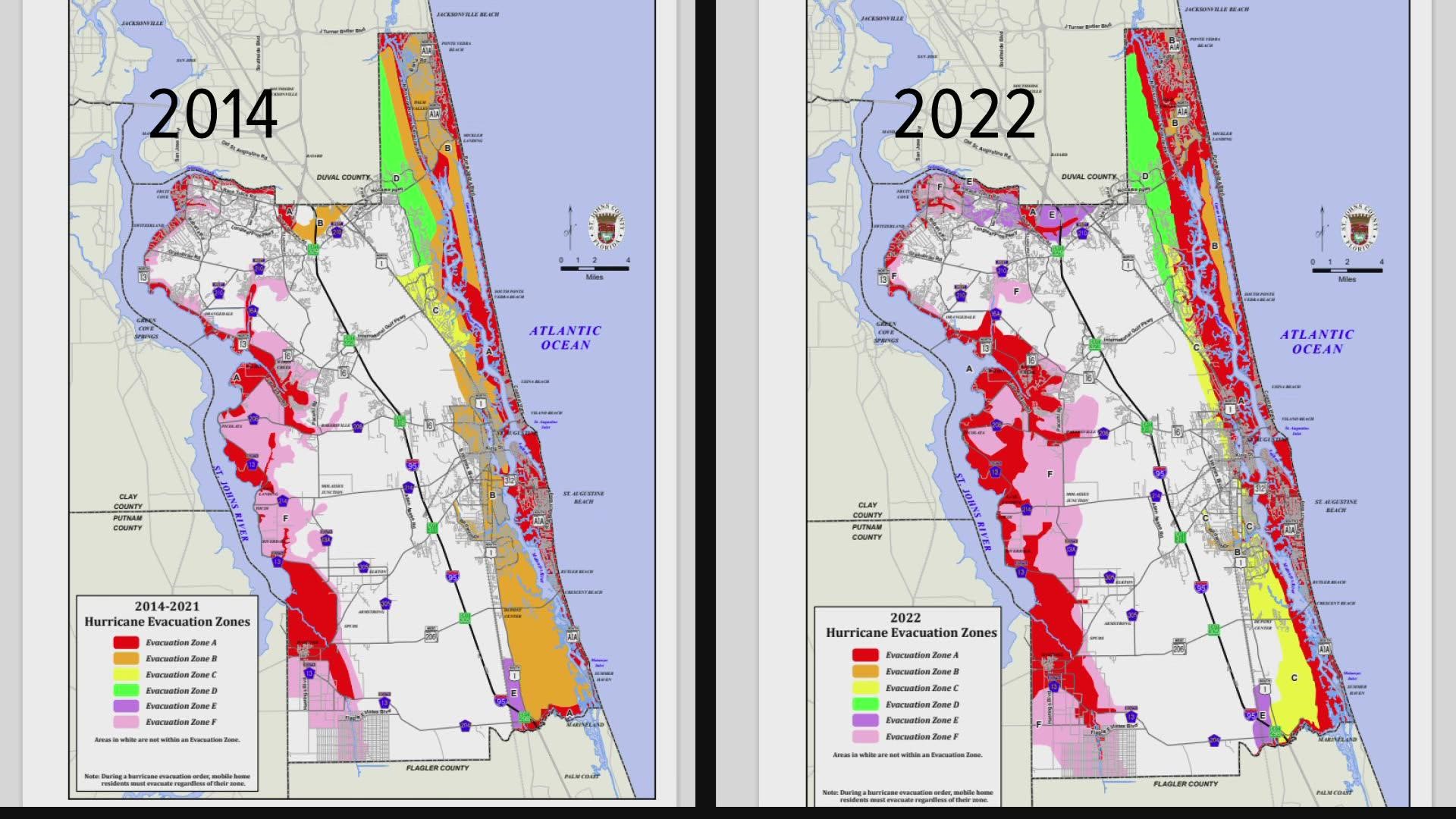
ST. JOHNS COUNTY, Fla — Hurricane season starts June 1 and hurricane evacuation zones just got an overhaul in St. Johns County. The county’s Emergency Management Director Joe Giammanco said the last map dates back to 2014, before Hurricane Matthew stormed by.
The red areas -- or Evacuation Zone A -- on the hurricane evacuation zone map are typically the first areas to be evacuated because they are the "most likely to be affected by storm surge," Giammanco said.
Some areas that were not in the red evacuation zone before are now red.
One example is the area along the western shore of the Sebastian River in St. Augustine. Homes in that area flooded badly in Matthew and Irma. That area was not red before. Now it is. And it’s even west of U.S. 1, but U.S. 1 is no longer the evacuation dividing line, Giammanco said.
"We’re at a more granular level to see where storm surge could potentially go and draw those lines accordingly," he noted.
Another change to the map: some areas that were in Evacuation Zone A (red areas) , such as most of the St. Augustine South neighborhood, are no longer in the red zone. New data accounted for the neighborhood’s high elevation.
"This is more accurate than drawing a straight line down the map," Giammanco said.
He noted that the new zone lines area not based on history. And while the lessons we learned from hurricanes Matthew and Irma are important, the new map zones are based on storm surge and topography.
The National Hurricane Center updated its modeling and information and, and "then the county looked at the information and drew the lines accordingly," Giammanco said.
He said the goal is to evacuate the area that only need to be evacuated.
"You don’t want people on the roads unnecessarily," he said.

