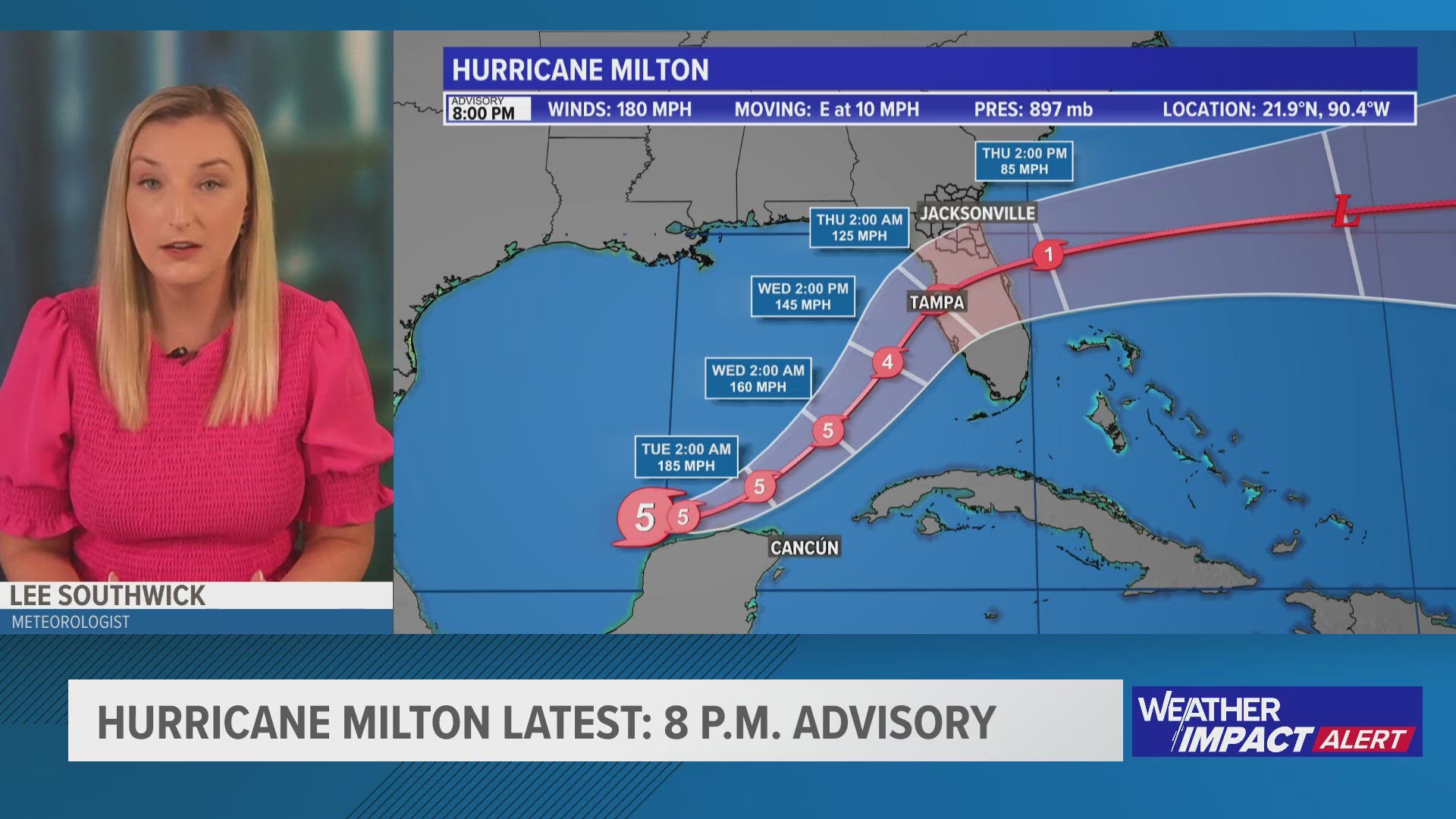
JACKSONVILLE, Fla. — Although only six counties in Florida have evacuation orders in place as of Monday morning — Manatee, Pasco, Pinellas, Hillsborough, Charlotte and Sarasota — Gov. Ron DeSantis said in a news conference Sunday morning that "there are gonna be calls for evacuations that will come," as Hurricane Milton approaches landfall in the state.
So far, there have not been evacuations ordered on the First Coast.
As forecast, Milton's impacts to the First Coast will arrive Wednesday, with the worst of the weather being Wednesday evening to Thursday morning.
So, for those who live in Northeast Florida or Southeast Georgia, do you know your zone? Here's a county-by-county guide to knowing yours.
What is my evacuation zone?
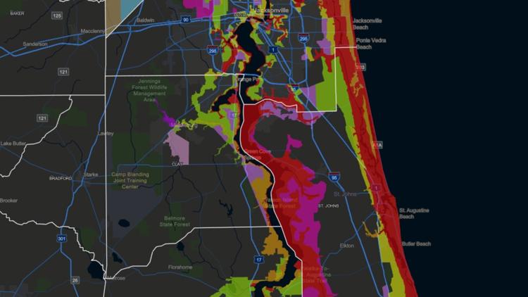
The Florida Division of Emergency Management's (FDEM) Disaster Preparedness Maps is a great site to bookmark. It breaks down evacuation zones, evacuation routes and provides storm surge maps.
Evacuation zones are broken down into zones A to L. Zone A is likely to be evacuated first, whereas Zone E is likely to be evacuated last, according to FDEM.
Be sure to keep up-to-date with any news conferences that the mayor or governor will have as Milton approaches. During these updates, the mayor or governor will say which zone should evacuate.
Northeast Florida
- Duval County >> Click here to find your evacuation zone by entering in your address
- Clay County >> Click here to find your evacuation zone and evacuation routes
- Putnam County >> Click here to find your evacuation zone by entering in your address
- Nassau County >> Click here to look at maps of evacuation zones in Nassau County
- Flagler County >> Click here to find your evacuation zone and evacuation routes
- St. Johns County >> Click here to find maps of evacuation zones and evacuation routes