
JACKSONVILLE, Fla. — The summer has been hot, but is there something that can be done about it?
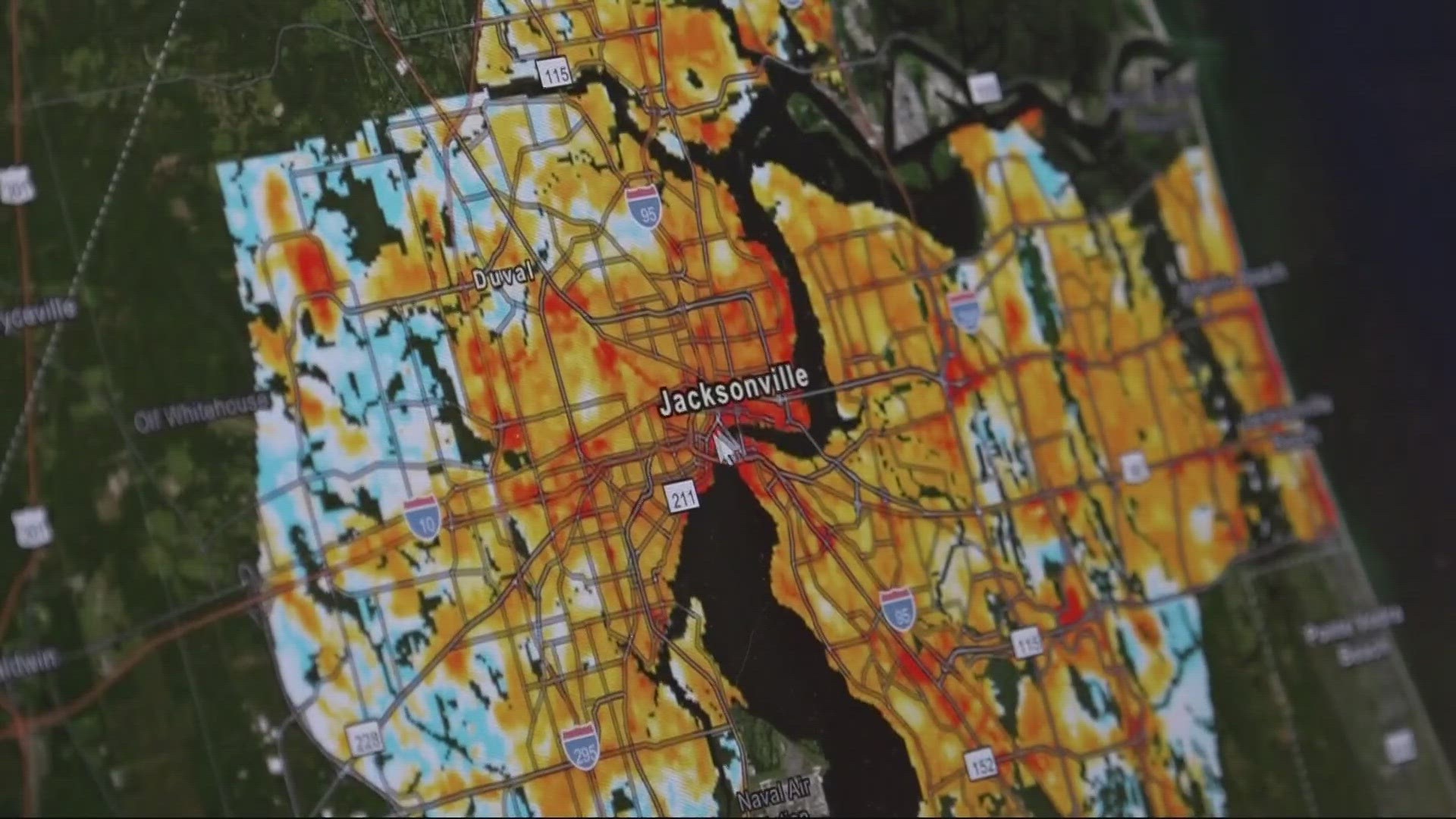
The city of Jacksonville and the University of North Florida teamed up for an urban heat study last year, creating a map of the hottest places in Jacksonville. Now, what will happen with those findings?
The information from the study is being used for the city to create a plan to alleviate heat stress, according to the UNF professor involved. It can also be used by you now. You can put your address in to see how great the risk of heat stress is where you live.
"The downtown core here is incredibly hot," said UNF Professor Adam Rosenblatt, showing First Coast News the results of the urban heat map.
"St. Johns Town Center is about 10 degrees hotter than these areas that are more forested over towards the east," he said, moving the map around. "If we zoom in on it, you can see why. Because it's just solid parking lots."
Rosenblatt says the city's chief resilience officer is making a plan using the results of the study.
"The plan will include steps for how to alleviate heat stress throughout the city," Rosenblatt said. "These things involve increasing the amount of trees that are planted. We need to change things like zoning regulations. We need to make it mandatory that if you're developing a residential neighborhood or developing a new shopping center, you have to have a certain amount of tree cover and you need to decrease the amount of parking lots and asphalt that are incorporated into that."
Rosenblatt says trees aren't the only answer, but they are the most obvious. Heat is the biggest weather-related killer, according to the National Weather Service. The CDC states there are more than 700 heat-related deaths every year in the country.
The World Meteorological Organization predicts this year is the beginning of the warmest five-year period ever recorded.
One thing you may notice on the heat map is that some of the lower-income areas are the hottest.
"It's not a perfect correlation," Rosenblatt said. "It's not like every high-income area is cool and every low-income area is really hot, but there are certain parts of the city, especially on the north side, where there are low-income communities that are exposed to extreme heat, whereas wealthier communities are not as prone to that issue."
He encourages you to look up your address on the heat map and talk to your city council member about what's being done to alleviate heat stress in your neighborhood.
The CDC advises you to pay attention to the weather, stay in cool places, and plan outdoor activities carefully. Find more tips to prevent heat-related illness here.
The city's public affairs office did not hear back from the chief resilience officer about doing an interview.
You can call 630-CITY to request city workers to plant a tree for free in the right-of-way in front of your home. Learn more here.